Looe Flood Defence and Regeneration Scheme

Share Looe Flood Defence and Regeneration Scheme on Facebook Share Looe Flood Defence and Regeneration Scheme on Twitter Share Looe Flood Defence and Regeneration Scheme on Linkedin Email Looe Flood Defence and Regeneration Scheme link

Update on Looe Flood Defence and Regeneration Scheme

During the past few weeks the Looe Flood Defence and Regeneration project team has been working very hard to finalise the Outline Business Case (OBC) so it can be submitted to the Environment Agency for technical assurance and a check on potential eligibility for flood defence funding (Flood Defence Grant in Aid (FDGiA).

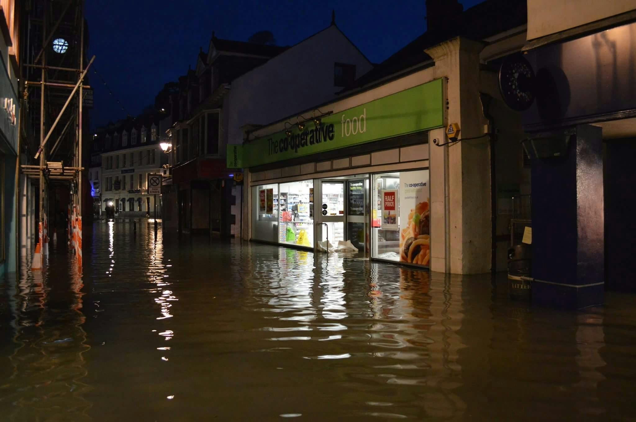
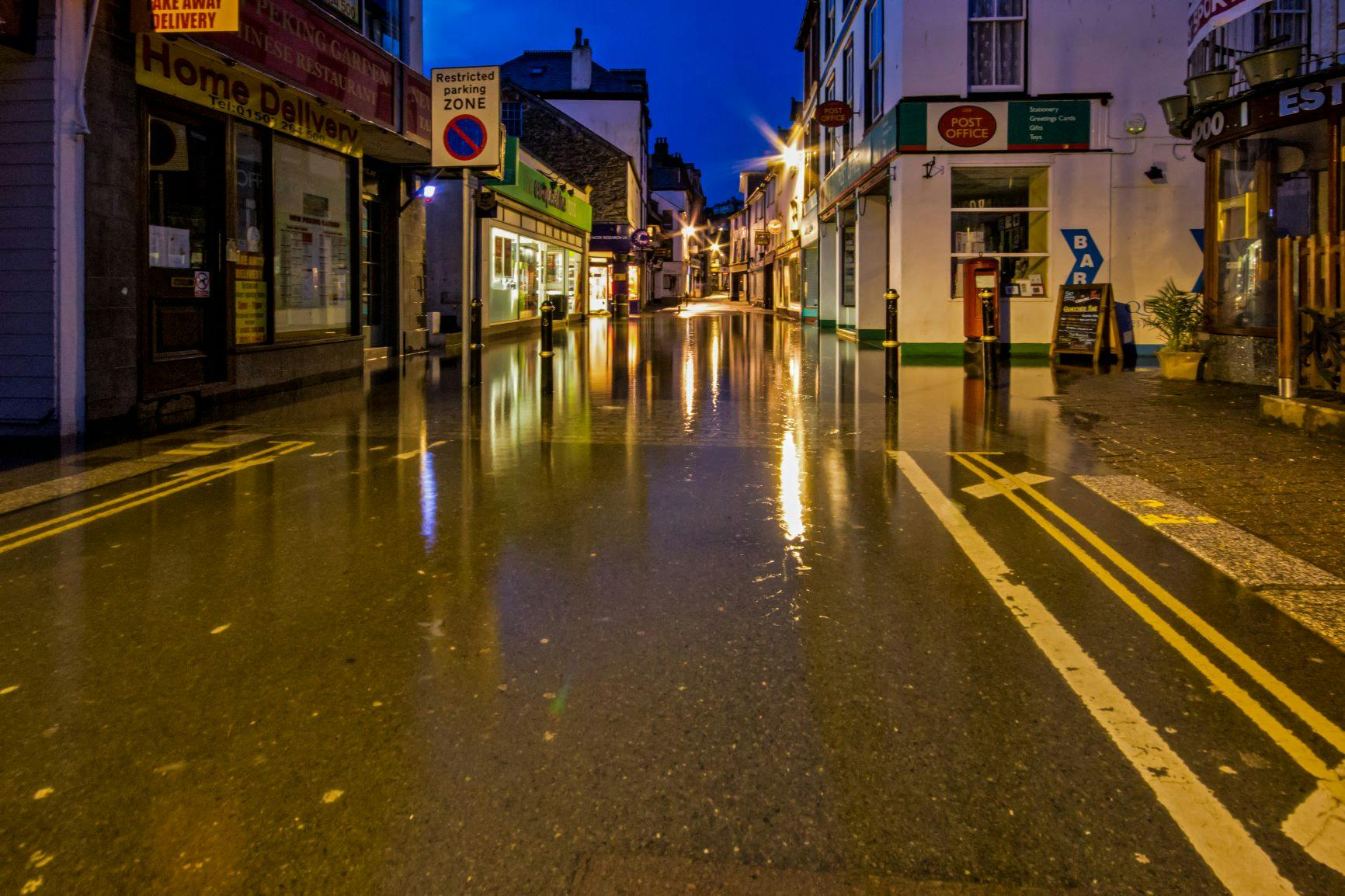
The importance of this scheme to the town was demonstrated earlier this month when Looe experienced flooding between 11 and 13 March.

The capital cost of delivering the scheme is currently estimated as £197m. Cornwall Council has been working closely with the Environment Agency on developing the scheme, with both providing funding for the studies and investigations done so far.

If the project does receive FDGiA funding from the EA, this will not cover the whole scheme costs and other funding streams will need to be secured. The likely figure for FDGiA will be £28.8million. The majority of the rest of the funding is likely to come from other government departments.

The process for securing the FDGiA involves the submission of the Outline Business Case to the Environment Agency for technical assurance.

This is an important step in ‘checking’ if the process that has been undertaken so far has been carried out properly and the conclusions are justified. It is likely that this process will be completed by the end of 2024.

The OBC needs to demonstrate how the scheme will protect key transport links, including main roads in and out of the town and rail services, residential and commercial properties, as well as how it will protect and enhance the visitor and marine economy. The enhancement and growth of the economy will be crucial for securing the additional funding for economic regeneration rather than the FDGiA – which has more of a focus on protecting the existing economy of the town.

Following the results of the most recent community engagement events, and the outcome of the assessment into the Save Banjo Pier option in January, it was agreed to focus on the Tidal Barrier with Breakwaters and the Tidal Barriers Only options to develop for the OBC.

This is important as the OBC is required to include information on all the options that have been considered for the scheme, together with details of the technical, environmental and economic criteria used to assess the options and the analysis which was carried out. The applicant is then expected to identify a recommended solution that will deliver the aims and objectives of the scheme and demonstrate a Benefit to Cost ratio of at least 1.

The OBC has now been submitted to Cornwall Council for review and comment. This identifies the Tidal Barrier and Breakwaters option as the recommended solution that will reduce flood risk and enable regeneration in Looe.

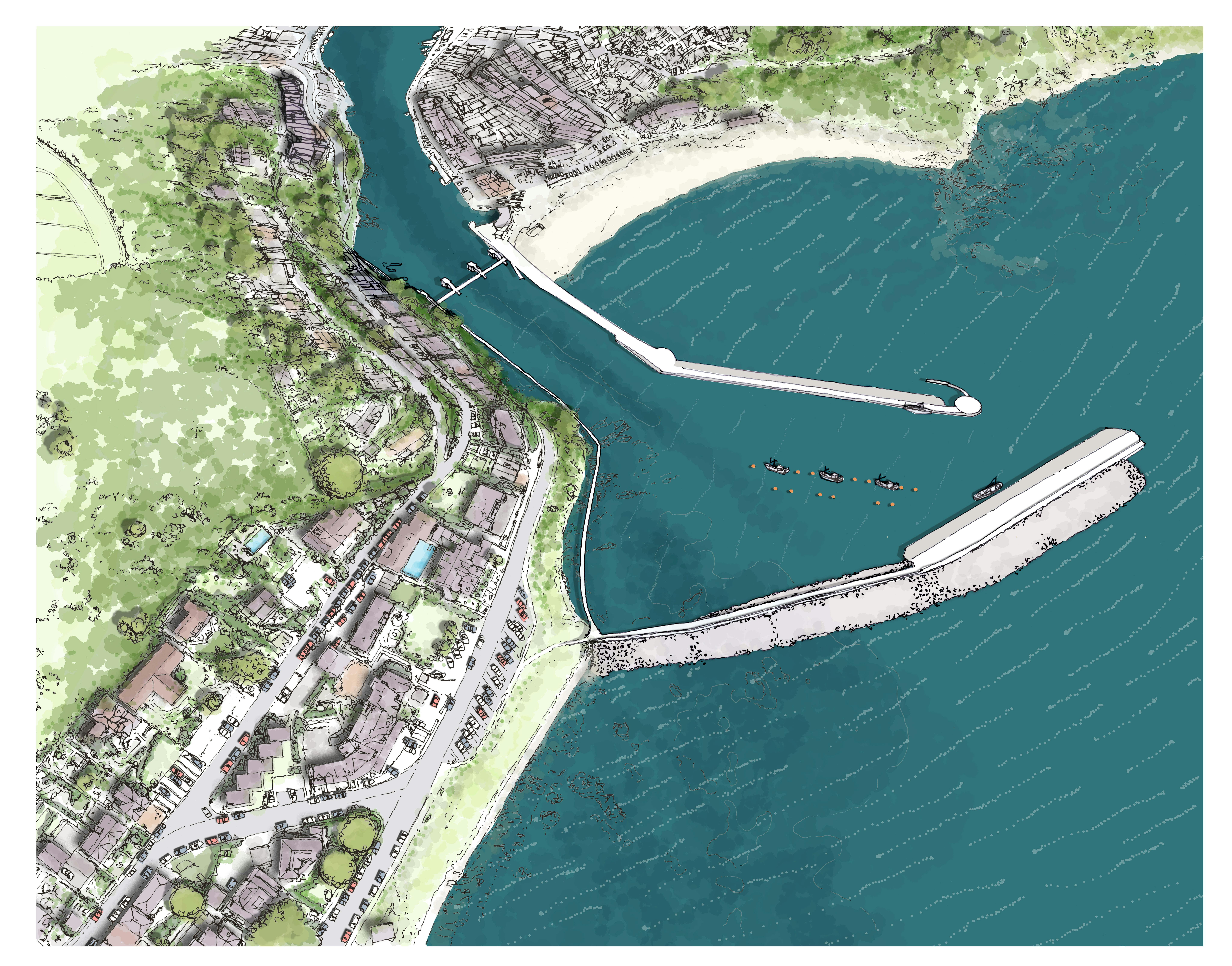
This option includes an extension to Banjo Pier, construction of a new southern breakwater, installation of an automated mitre gate, cut off walls to East Looe, Hannafore Walkway, and a pontoon and moorings in the new harbour. It will provide protection for 1:200-year storm event up to the 2120’s.

As well as demonstrating the technical feasibility of this option, the OBC sets out how it will help to promote economic growth. It also defines the scope of environmental issues that will require further assessment. The OBC will be initially reviewed by a number of internal boards before being submitted to the Council’s Cabinet for approval.

Following the process of Cornwall Council approval and Environment Agency assurance, the OBC will then be ready to submit to other government departments for application for funding to match fund the potential FDGiA.

Subject to securing funding, the project will move into its ‘Detailed Design Stage’. During this stage an Environmental Impact Assessment (EIA) will be carried out, applications for Planning Permission, a Harbour Revision Order and a Marine License will be prepared and submitted, negotiations with affected landowners will begin and tenders will be issued to select a contractor to carry out detailed designs and construction works.

It is currently anticipated that this could be achieved towards the end of 2026, with construction then taking place over the following three years.

Securing the funding needed to protect Looe from flooding in the future will require the whole town to work together. There are many other places across the country seeking funding for flood prevention works and the Government and other potential investors.

It will be important to show significant support for the final scheme and we look forward to working with stakeholders and partners to make Looe’s case.

You can contact us via email at LooeFloodDefence@wsp.com

You can watch a short film explaining about the aims of the Flood Defence and Regeneration Scheme and the seven current options below:

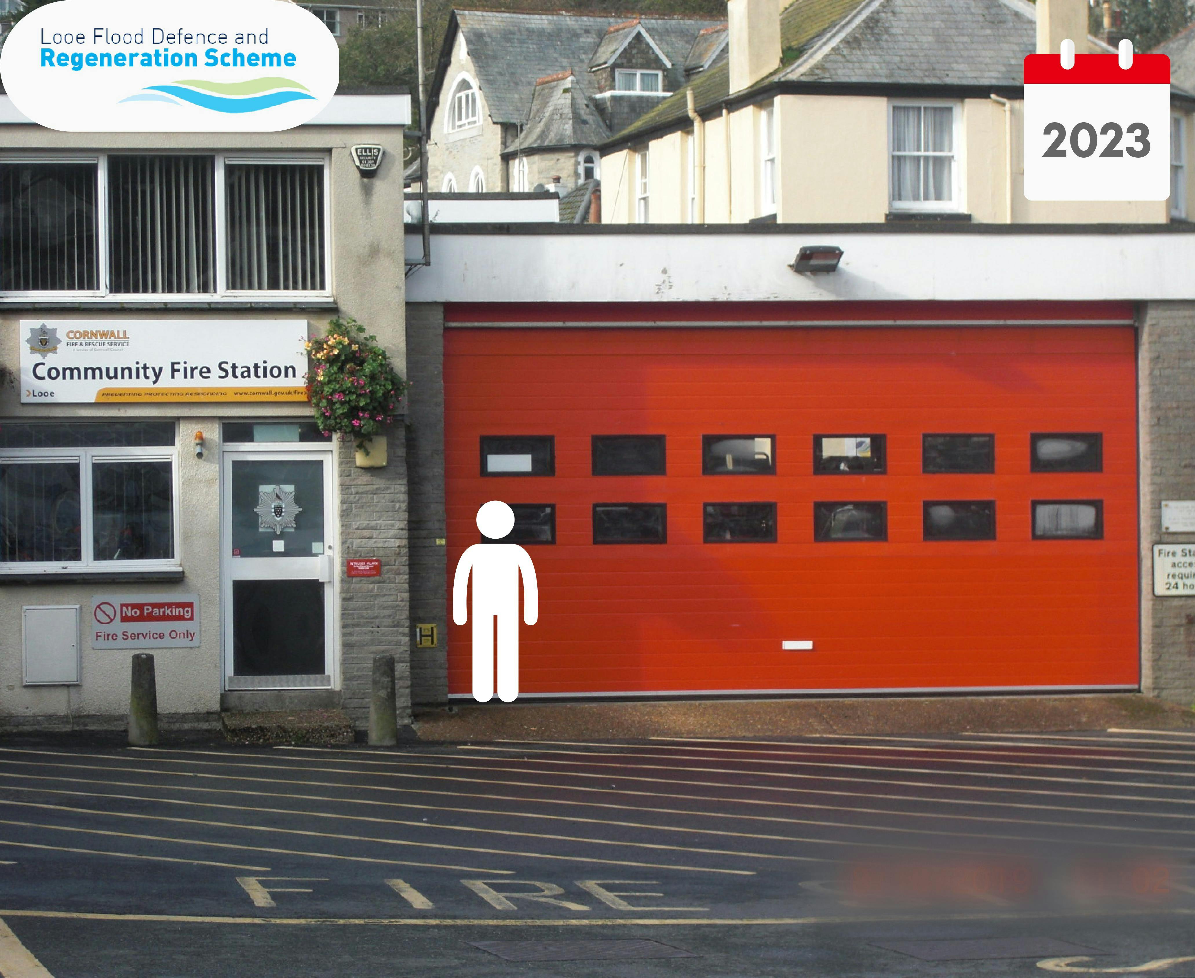
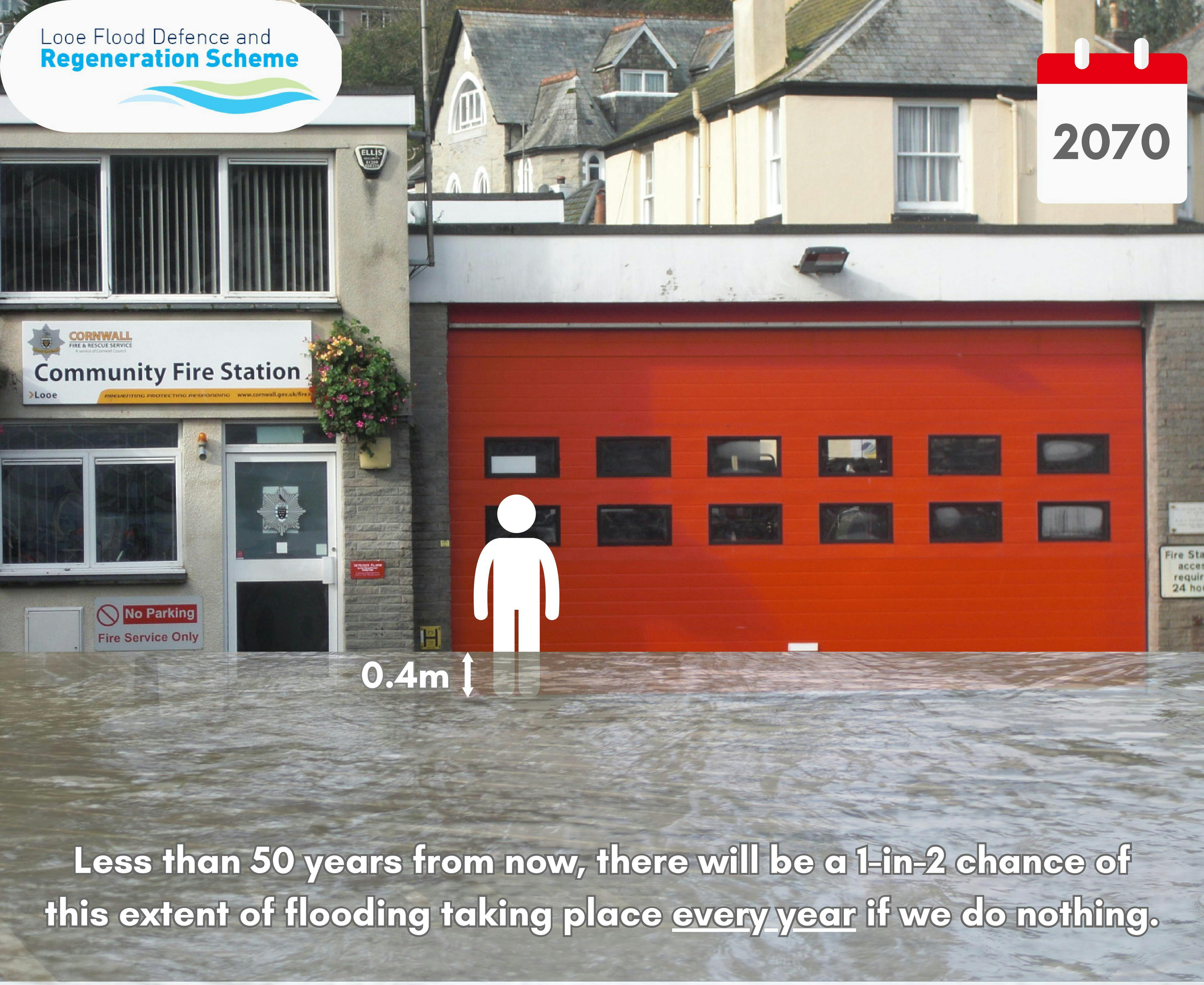
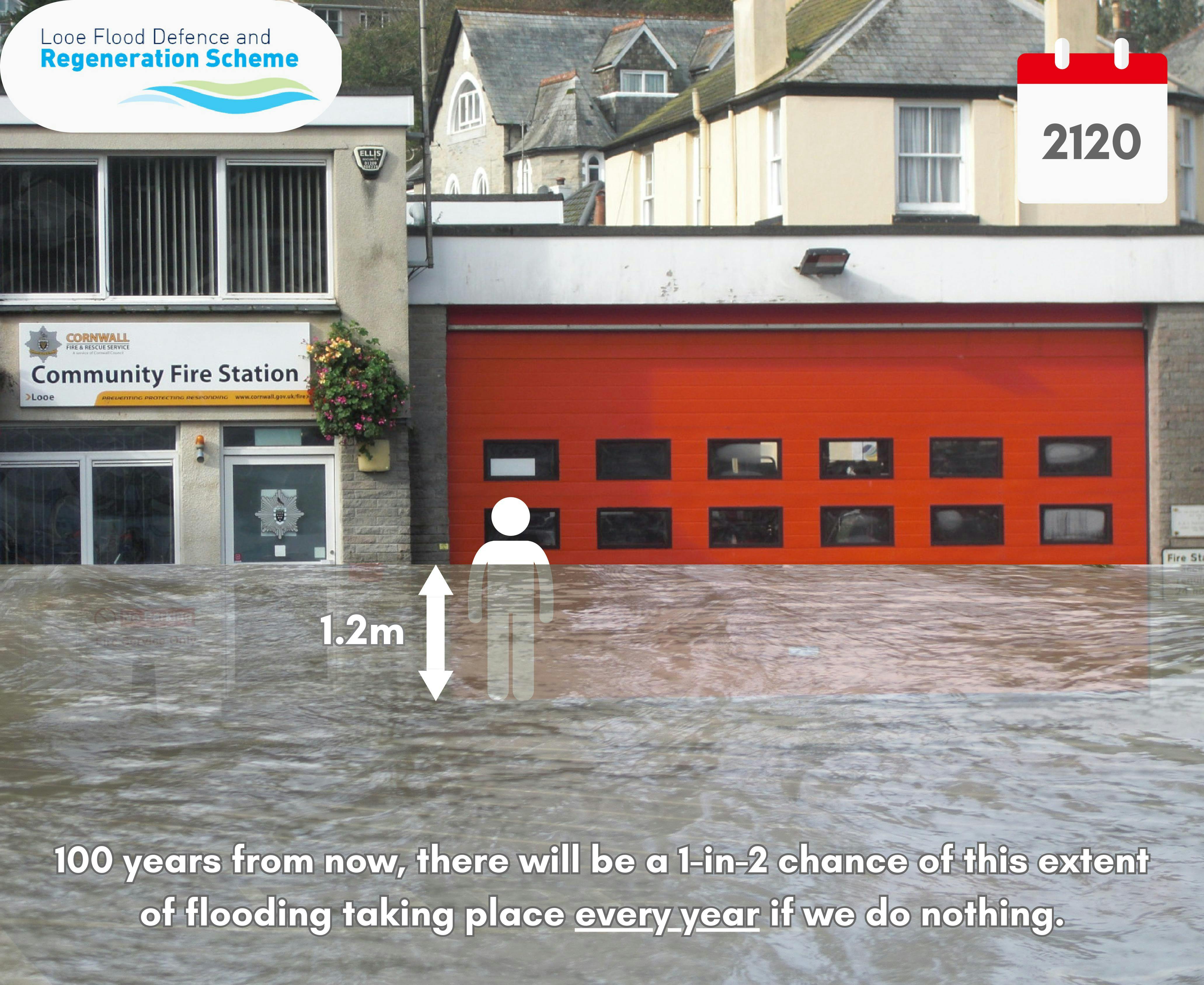
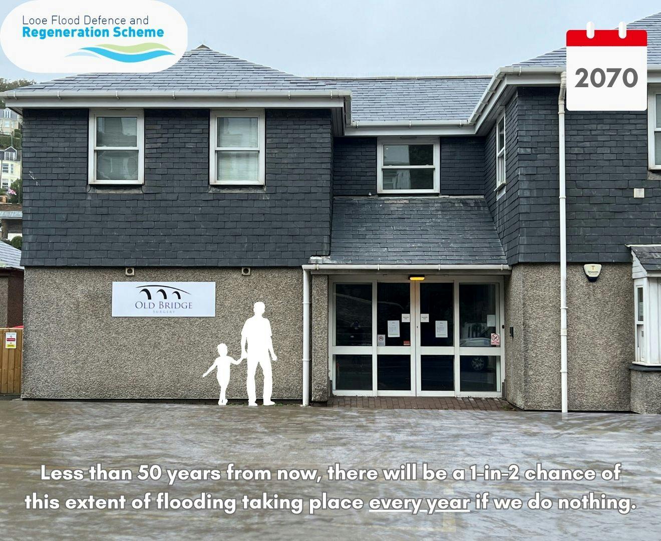
Check out this latest animation showing how flooding will affect Looe in 2070.

Stop press……

The Environment Agency have introduced a new way to make it quicker and easier for people to talk to them about flood risk – if you have a smart phone you can now use a QR code or send a text message to contact them.


About the Looe Flood Defence and Regeneration Scheme

The unique geographic features of Looe already make the town vulnerable to flood events. Sea levels are projected to rise more rapidly due to climate change, increasing the extent, depth, and frequency of flood events.

Urgent action needs to be taken to reduce the extremely high risk of further coastal flooding and erosion in Looe.

The main aims of the proposed Flood Defence and Regeneration Scheme are to:

  • Protect Looe from frequent and severe flooding and damage over the next 50 – 100 years, giving the community time to adapt to a changing climate
  • Enhance the environmental integrity of the designated sites and water bodies
  • Work to promote economic growth in East Cornwall by
    • Protecting key transport links
    • Protecting and enhancing the visitor and marine economy

By delivering a scheme which reduces the risk of flooding, attracts widespread support, secures all the necessary approvals and permissions, and is capable of being funded, we can protect homes, businesses and key transport links in and around the town, at the same time as enhancing the marine and visitor economy.

This is a major project which will have a significant impact on the town.

A number of different options have considered as potential solutions during the past 20 years. Following detailed consideration, only one – the tidal barrier scheme – was considered viable.

In July 2015 Looe Harbour Commissioners funded work to develop proposals for a new food defence scheme. The outcome was supported by 95% of local residents and landowners.

in 2020 Cornwall Council’s Cabinet agreed to support the development of the Looe Flood Defence project, allocating £2.3m from the South-East Cornwall Regeneration Programme.

In 2021 the project was awarded a £2.3 million Defra Flood Defence Grant in Aid grant. This is being used to complete work on preparing the outline business case– the next key stage in securing the Government, and other sources of funding, needed to deliver the scheme.

The scheme is being led by Cornwall Council and the Environment Agency. The partners are also liaising with a number of local organisations, including Looe Harbour Commissioners, Looe Town Council, Looe Development Trust, West Looe Town Trust, East Looe Town Trust, the RNLI and local MP Sheryll Murray to turn the proposals into an economically viable and environmentally friendly solution to the town’s tidal flooding challenges.

There was overwhelming public support for the proposals put forward by the Harbour Commissioners in 2015 and we want to work with the local community to shape the final scheme.

You can view a short film about the scheme below:


Current Timeline

  • Completion of Outline Business Case Spring 2024
  • Funding decision 2024
  • Detailed design 2025
  • Harbour Revision Order Application 2025 - 2026
  • Planning Approval 2026
  • Construction 2026 / 2029


You can give us your views on the proposals on our discussion forum. You can also email us at LooeFloodDefence@wsp.com


Questions about the scheme

Let us know if you have any questions about the Looe Flood Defence and Regeneration scheme. We'll try and answer them as soon as we can. You can also e-mail us at LooeFloodDefence@cornwall.gov.uk 

loader image
Didn't receive confirmation?
Seems like you are already registered, please provide the password. Forgot your password? Create a new one now.
  • Share Can you please share the exact co-ordinates of the 'outer harbour' walls ie. the breakwater and extended Banjo Pier? The reason I'm asking is because the Looe Sea Swimmers swim to several buoys off East Looe Beach. East Looe Beach is a safe beach because the Banjo protects water users from the dangerous river and harbour mouth currents. If the 'outer harbour' is built the redirected river and harbour mouth currents may make it less safe for swimmers and other water users to use the beach. It's very difficult to judge the reach of the 'outer harbour' walls from the diagrams and videos. Can you please confirm the 'outer harbour' walls exact positions. Thank you. on Facebook Share Can you please share the exact co-ordinates of the 'outer harbour' walls ie. the breakwater and extended Banjo Pier? The reason I'm asking is because the Looe Sea Swimmers swim to several buoys off East Looe Beach. East Looe Beach is a safe beach because the Banjo protects water users from the dangerous river and harbour mouth currents. If the 'outer harbour' is built the redirected river and harbour mouth currents may make it less safe for swimmers and other water users to use the beach. It's very difficult to judge the reach of the 'outer harbour' walls from the diagrams and videos. Can you please confirm the 'outer harbour' walls exact positions. Thank you. on Twitter Share Can you please share the exact co-ordinates of the 'outer harbour' walls ie. the breakwater and extended Banjo Pier? The reason I'm asking is because the Looe Sea Swimmers swim to several buoys off East Looe Beach. East Looe Beach is a safe beach because the Banjo protects water users from the dangerous river and harbour mouth currents. If the 'outer harbour' is built the redirected river and harbour mouth currents may make it less safe for swimmers and other water users to use the beach. It's very difficult to judge the reach of the 'outer harbour' walls from the diagrams and videos. Can you please confirm the 'outer harbour' walls exact positions. Thank you. on Linkedin Email Can you please share the exact co-ordinates of the 'outer harbour' walls ie. the breakwater and extended Banjo Pier? The reason I'm asking is because the Looe Sea Swimmers swim to several buoys off East Looe Beach. East Looe Beach is a safe beach because the Banjo protects water users from the dangerous river and harbour mouth currents. If the 'outer harbour' is built the redirected river and harbour mouth currents may make it less safe for swimmers and other water users to use the beach. It's very difficult to judge the reach of the 'outer harbour' walls from the diagrams and videos. Can you please confirm the 'outer harbour' walls exact positions. Thank you. link

    Can you please share the exact co-ordinates of the 'outer harbour' walls ie. the breakwater and extended Banjo Pier? The reason I'm asking is because the Looe Sea Swimmers swim to several buoys off East Looe Beach. East Looe Beach is a safe beach because the Banjo protects water users from the dangerous river and harbour mouth currents. If the 'outer harbour' is built the redirected river and harbour mouth currents may make it less safe for swimmers and other water users to use the beach. It's very difficult to judge the reach of the 'outer harbour' walls from the diagrams and videos. Can you please confirm the 'outer harbour' walls exact positions. Thank you.

    FionaA asked over 1 year ago
    Thank you for your email regarding sea swimming at Looe.
     
    It is proposed that the Banjo Pier is extended a further 170m - 225m out to sea from the end of the existing structure, and this extension along with the Southern Breakwater will form a refuge area.
     
    In terms of impacts on sea swimming, the new structures will:
     - shelter the beach more from south/south west waves
     -  direct river and harbour currents further offshore away from beach users
     -  direct pollutants (such a CSO spills) further offshore away from beach users
     -  direct boats further offshore away from beach users
     
    As part of the design, we will be undertaking a navigation risk assessment, is there an organisation who represents sea swimmers we could engage with if our design team would like to dicuss the sea swimming at Looe in more detail?
Page last updated: 28 Mar 2024, 09:30 AM