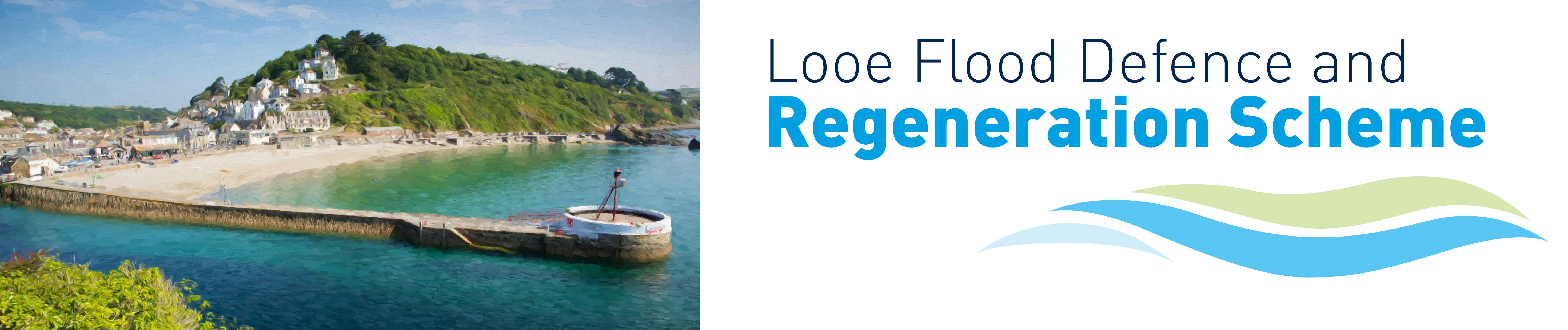
FAQs
- Adaptation of the town/community
- Demountable Barriers
- Permanent Flood Walls
- Quayside Extension
- Tidal Barrier only
- Tidal Barrier with Breakwaters
- Dredging
- Breakwaters only
- Tidal barrier with small breakwater
- Protect Looe from frequent and severe flooding and damage over the next 50 – 100 years, giving the community time to adapt to a changing climate
- Enhance the environmental integrity of the designated sites and water bodies
- Work to promote economic growth in East Cornwall by
- protecting key transport links
- protecting and enhancing the visitor and marine economy
- The costs of building and operating the scheme
- The effectiveness in protecting the town from the risks of tidal, river, groundwater and surface water flooding
- Potential challenges in constructing and operating the flood defences
- Impact on the marine environment, landscape and seascape and carbon emissions
- Navigation issues
- Impact on heritage and amenities
- Economic benefits
- Dredging - flooding at Looe from the sea results from tides and low pressure causing higher than usual sea levels. Dredging would not reduce sea levels or the risk of tidal flooding
- Breakwaters only - while constructing breakwaters would reduce wave action, they would not reduce high sea level and the increasing risk of tidal flooding due to sea level rise
- Tidal barrier with small breakwater - raising Banjo Pier and adding a small breakwater would reduce wave action at the tidal barrier, enabling a lower tidal barrier to be built. However, this particular option has been ruled out on the grounds of navigational safety as vessels would have to turn side on to waves close to the beach
- Estimating how much sediment enters the system from the East and West Looe Rivers
- Determining what local scour/accretion effects could occur around the new structures - and then if this would impact (positive or negative) on the seagrass habitat
- Determining if the increased wave reflection of the new breakwaters will affect the sediment mobility/seagrass habitat
- Build less - for example considering using existing buildings to store spares for the barrier instead of building a new one
- Build clever – for example looking at lower carbon alternatives to traditional Portland cement in concrete
- Build efficiently – for example using modern methods of construction to reduce waste
- Estimating how much sediment enters the system from the East and West Looe Rivers
- Determining what local scour/accretion effects could occur around the new structures - and then if this would impact (positive or negative) on the seagrass habitat
- Determining if the increased wave reflection of the new breakwaters will affect the sediment mobility/seagrass habitat.
- Provide information for decision-making on the environmental consequences of projects.
- Promote environmentally sound and sustainable development through the identification of appropriate enhancement and mitigation measures.
- Hydrodynamic Modelling (including Water Quality).
- Wave Modelling.
- Water Framework Directive Walkover Survey.
- River Condition Assessment Surveys.
- East and West Looe Electric Fishing Surveys.
- eDNA Surveys.
- Intertidal Surveys.
- Subtidal Surveys.
- Stalked Jellyfish Survey.
- Seagrass Surveys.
- Underwater Noise Survey.
- Acoustic Doppler Current Profiler (ADCP) Monitoring.
- Terrestrial Preliminary Ecological Appraisal.
- Bat Surveys.
- Heritage Walkover Survey.
- Contaminant Analysis.
- Landscape Viewpoint Surveys.
- Transport survey
- Build less - for example identifying ways in which each option could reduce material use.
- Build clever – for example looking at lower carbon alternatives to traditional Portland cement in concrete.
- Build efficiently – for example using modern methods of construction to reduce waste.
- SWW Storm Overflows Discharge Reduction Plan.
- Environment Act 2021.
- SWW Drainage and Wastewater Management Plan.
- SWW Vision 2020-2050.
- Government’s Ten Point Plan for a Green Industrial Revolution. A high density of blockages have been identified by SWW in Looe.
- Cornwall Council
- Looe Harbour Commissioners
- Environment Agency
- Looe Town Council
- Looe Development Trust
- West Looe Town Trust
- East Looe Town Trust
- RNLI
- WSP
Looe has always flooded – local residents and businesses know how to protect their properties so why do we need a food defence scheme ?
It is certainly true that Looe has a history of flooding. During the fortnightly spring tides, the sea routinely reaches the top of the quayside walls. When a storm occurs at the same time, the water comes over the quay wall and floods the surrounding areas. Environment Agency records show that currently the centre of the town typically floods two to four times a year, putting more than 200 properties at risk. By 2050 this will rise to 60 times a year, with the risk of a 2014 type flooding event happening every year.
While the resilience of local residents using flood boards etc may be enough to protect the town from all but the most severe storms today, this will not be the case in the future. The impact of climate change, with sea levels expected to rise by over one metre during the next 100 years, means that in less than 50 years most of the town will flood more often and to a greater depth. This will see key areas such as the health centre, the police and fire stations, the main food stores and cafes and the fish market, the main roads, the Harbour and Millpool car parks and the railway line under water on storm and high tide days.

I have not seen any evidence that flooding is getting worse.
During the fortnightly spring tides the sea routinely reaches the top of the quayside walls. When a storm occurs at the same time – as happened in 2014 - the water comes over the quay wall and floods the surrounding areas. Environment Agency records show that currently the centre of the town typically floods two to four times a year, putting more than 200 properties at risk. The most recent flooding happened on March 23 and 24th this year with roads, rail lines and car parks closed because they were flooded, leaving local people unable to access their homes and businesses.
However the real issue is not with what is happening today – it is what will happen during the next 100 years when rising sea levels will mean the town floods more often and to a greater depth. This will mean more homes and businesses, and key areas such as the health centre, the police and fire stations, the main food stores and cafes and the fish market, the main roads, the Harbour and Millpool car parks and the railway line are flooded on storm and high tide days . This is why a flood defence scheme is being investigated for the town.


What will the impact of climate change be on the town ?
Sea levels are expected to rise by over one metre during the next 100 years. This means that in less than 50 years most of the town will flood more often and to a greater depth. This will see key areas such as the health centre, the police and fire stations, the main food stores and cafes and the fish market, the main roads, the Harbour and Millpool car parks and the railway line flooded on storm and high tide days.

The Environment Agency estimates that this will see the centre of Looe flooding flood 60 times a year by 2050, with the risk of a serious flood incident, such as occurred in 2014, rising from a one in 1000 year event to it happening every year by 2080.

Will the rise in sea levels mean more areas of the town are flooded in the future.
Yes – by 2070 key areas such as the health centre, the police and fire stations, the main food stores and cafes and the fish market, the main roads, the Harbour and Millpool car parks and the railway line will be flooded on storm and high tide days .

Why can’t people just use sandbags and flood defences to protect their properties
Currently most residents and businesses say they can protect their properties from all but the worst flooding using these measures. However, even today, this is not enough to protect against the impact of more severe flooding such as experienced in 2014 when shops, businesses and homes were under more than a foot of water, the roads in and out of the village impassable and the railway line flooded.
Flood Boards (and other measures) can only work to a certain height before other considerations such as structural damage and toilet back flow create more pressing problems for buildings (see Adaptation).
The predicted rise in sea level means that in less than 50 years most of the town will flood more often and to a greater depth and flood barriers and sandbags will not be enough. More areas of the town will also be affected by floods – including key areas such as the health centre, the police and fire stations, the main food stores and cafes and the fish market, the main roads, the Harbour and Millpool car parks and the railway line .

What will happen if nothing is done to prevent flooding
If nothing is done, repeated and increasingly severe flooding will affect key areas such as the health centre, the police and fire stations, the main food stores and cafes and the fish market, the Harbour and Millpool car parks as well as sewers, electricity and other services and vital rail and road infrastructure.


This would lead to the long term decline of both the local and wider South East Cornwall economy, as visitor numbers reduce and businesses move away, costing the town around £160m and the potential loss of over 1,400 jobs by 2120 as the flood risk escalates. More homes and businesses will become uninhabitable or uninsurable, with environmental risks such as sewer storm overflows during flood events impacting the beaches and bathing water quality.
Which options have been considered for the flood defence scheme?
The project team have looked in detail at 9 potential options (including those which had been previously dismissed) for the flood defence scheme.
These are:
After assessing all the options against a range of a range of technical, economic and environmental criteria, three options – dredging, breakwaters only and a tidal barrier with small breakwater - were ruled out.
Work has continued on assessing the remaining six options to decide which best meets the aims of the Flood Defence and Regeneration scheme which are to
What criteria have you used to assess the different options?
The project team have assessed all potential options (including those previously dismissed) against a range of technical, economic and environmental criteria. These include:
What options have been ruled out and why will they not work?
After assessing all potential options against a range of technical, economic and environmental criteria, the options below were ruled out for the following reasons :.
What are demountable barriers and how would they work?
Also known as removeable flood barriers, the barriers consist of a series of panels which slide into upright fixings to create a flood wall around 2 metres high, with a cut off wall approximately 10m beneath it to prevent bypass via the ground.

Work on the drainage system would also need to be carried out to prevent backing up of drains and sewers, and a storage facility constructed on high ground around the town to store barriers and plant. The cut off wall would probably be created with piled or grouted walls built below ground close to existing buildings with attendant disruption, noise and vibration.
The barriers would need to be erected one to two days before a flood is forecast, and then taken down afterwards using temporary traffic lights where the road is narrow in East & West Looe Considerable manpower is required and erecting the barriers will cause disruption to traffic and pedestrians. While the impact on access to the harbour and any visual impact would be limited when the barriers were not in use, the impact would be much greater when they were erected.
As well as the costs of building the cut off wall and foundations, the scheme will also be expensive to operate once it is in place due to the length and potential frequency of the deployments. Demountable barriers would not protect areas upstream of Looe bridge with disruption to the main road and rail links increasing over time, and areas such as Millpool car park increasingly unavailable for visitors.
What is a permanent wall and how would this option work ?
This would involve creating a permanent flood wall approximately 2m high around the harbour, with flood gates for access in East and West Looe.

As with the demountable barriers, there will need to be a cut off wall and piled and grouted walls constructed below ground, along with work to the drainage system. Along narrower roads and tighter areas of the town this will include building the flood wall against existing buildings and reinforcing doorways and windows to minimise the footprint of the defences. Access to these properties would be restricted during a flood event.
While a permanent wall would mean low operational and maintenance costs, the costs of constructing the flood wall, cut off wall and foundations will be high as well as causing disruption, noise and vibration to residents and businesses. Having a 2 metre high permanent flood wall would have a very big visual impact and may alter the appearance and use of some properties, with access to the harbour limited by the location of the flood gates.
For the same reasons as Demountable Barriers, Permanent Flood walls would not protect Looe upstream of Looe Bridge.
What is the quayside extension option and how would it work?
Extending the quayside around the harbour would enable the ground level to be raised and new areas created for seating and pedestrian use.

The new quay walls would be built in front of the existing quayside, reducing disruption and allowing the construction to mostly take place from the water. Flood gates would likely be required at some points, for example, such as at slipways.
This option would have lower operational and maintenance costs, with the scheme able to be designed so it can be raised over time and adapted to sea level rise, with the new walls textured to echo finishes of existing granite walls.
However, the new structures would cover up the historic quay walls and reduce space within the harbour, with the wall still relatively high compared to the town and existing buildings.
For the same reasons as Demountable Barriers, a Quayside extension would not protect Looe upstream of Looe Bridge and demountable barriers or gates would be required on both sides of the town at the northern end to prevent flood flows from coming around the defences which, in East Looe, would cut off access to the town centre.
What is the tidal barrier option and how would it work ?
The barrier would only be closed when high tides are predicted to coincide with storm surges to the point where flooding of Looe is possible. This will be a relatively infrequent event (10 -20 times per year) when the scheme first opens. However, as time progresses and sea levels continue to rise, the frequency of closures will increase.
The tidal barrier will need to close at around mid-tide, so that there is sufficient volume upstream to manage the risk of flooding from East and West Looe Rivers.
While a tidal barrier could be built without the breakwaters, it would need to be higher and more robust to cope with increased wave action and created wave reflection. Without breakwaters, construction would need to take place over the summer to avoid the worst weather. Commercial vessels would need to be relocated during construction and to shelter elsewhere when the barrier was closed.

tidal barrier closed

tidal barrier open
This option would significantly reduce capital costs as well as removing the visual and marine impacts of the breakwaters themselves, with a rising sector gate (like the Thames barrier) used to cope with the more exposed conditions and to provide more operational flexibility. However, as it would not be possible for the barrier to be adapted to rising sea levels in the future, the crest level of the barrier will be above head height and the cylinder to move it around would be at the eaves level of the adjacent properties. – significantly increasing the visual and heritage impacts.
A large control building will be required due to the large volumes of hydraulic oil required for this structure, and a new sub-station likely required on the sea front. Due to the shape of the tidal barrier itself, a large recess is required in the sill for it to sit in when open, and therefore construction is likely to require breaking out of some of the rock along its alignment.
Unlike the demountable, permanent flood wall and quay side extension options, a “tidal barrier only” scheme would protect the entirety of Looe and not just that part downstream of Looe Bridge.
But it will not stop all types of flooding and heavy rainfall could still cause local surface water flooding within the town. However, reducing the sea level on the harbour side of the barrier will enable water to drain away quicker than it would otherwise do during a high water storm surge.
However, Looe has a statutory Open Port Duty. Currently there is unimpeded access into the harbour. When fully closed, and for periods during construction, a tidal barrier would prevent access to the harbour and vessels would need to be diverted to other harbours. Hence the option would be in breach of the harbour’s legal duties and a specific Order would be required from government to enable the project to proceed. The RNLI would launch downstream of the barrier, and access would not be impeded although the wave climate in which they launch is likely to be worse due to reflection of waves from the barrier gate when closed.
What is the tidal barrier with Banjo Pier extension and southern breakwater option and how would it work
This option includes extending Banjo Pier and building a southern breakwater to create a refuge area to shelter the tidal barrier and provide safe refuge for vessels from Looe during construction and the longer term.

A tidal barrier would be constructed in the shelter of the above. This would be designed to a lower level initially and could then be raised to cope with rising sea level in the future.

flood gates closed

flood gates open
A walkway bridge would be provided between Pennylands and Hannafore Point to allow a safe route for pedestrians and has the potential to become an additional attraction in its own right, offering new views along Looe River and increasing footfall along the SW Coastal Footpath.
Following feedback from the previous consultation, the route of the proposed walkway has been adjusted to bring it closer into the cliff face, while balancing the risk of cliff falls. The breakwater designs have also been adjusted to use granite rock armour, rather than concrete armour units.
Pontoons would be provided alongside the Banjo Pier extension to allow for safe access to tripping boats for the public, and a limited number of fixed moorings in the refuge area for use when the barrier is closed.
Although there would be some visual impact from the scheme and potential impact on the marine environment, the reduced height of the barrier would help to reduce this impact, with the breakwater and Banjo Pier extension designed as far as practicable to incorporate marine ecological enhancement features.
While the costs of delivering the scheme would be higher than some other options, this option would support the regeneration of Looe by providing greater access to the water and allowing tripping boats and ferries to access Looe at all states of the tide. This would support the development of new ferry routes and provide berthing for the fishing fleet with 24 / 7 access to the sea, as well as providing area of safe refuge for all boats behind it.
Improved accessibility will help to support tourism, increasing the vibrancy of Looe’s town centre and attracting more businesses and residents into the area.
In the same way as a “Tidal barrier only” scheme, a “tidal barrier with breakwaters” scheme would protect the entirety of Looe. In addition, the refuge area created by the breakwaters enable the harbour authority to comply with its statutory legal obligations to comply with its Open Port Duty and Safety of Navigation.
Access to deeper water will also enable substantial improvements to Looe’s economy by being able to accept coastal ferries with visiting passengers and will allow boat access to the sea on an all-day basis, rather than the tidal basis currently experienced.
Will the tidal barrier affect access into the harbour?
We are currently in discussions with the harbour users to determine the correct sill height, however current access should be relatively unaffected.
The intention is that the extension to Banjo Pier will enhance access to water as it will enable access for most, if not all, of the normal tidal states.
Access into the harbour will be restricted during construction, hence we will need to provide moorings outside of the proposed barrier for larger vessels whilst the barrier structure is built. These are unlikely to be anchorages, as that would have an impact on the seabed - rather they will be fixed pile, wall or fore and aft moorings.
Once functioning, the barrier will only be closed when high tides are predicted to coincide with storm surges to the point where flooding of the town is possible.
Why do we need a breakwater as well as the tidal barrier?
For the tidal barrier to work to its full potential it needs to be protected from the ever-increasing size of waves that will occur due to the increased water depth from sea level rise. A breakwater is a means of achieving this.
The combination of an extension to Banjo Pier and a southern breakwater will provide a protected refuge area for vessels. This will be useful during the construction of the barrier and provide a location for boats to moor outside the harbour when the barrier is closed.
The breakwater also improves access for tripping boats and coastal ferries to Looe, so boats can enter and leave the harbour at any tide. This will help boost Looe’s fishing, trading and tourism economy and contribute to the wider economic prosperity and regeneration of South East Cornwall
How will you prevent the breakwaters affecting the image of Looe?
The attraction of Looe to many tourists is one of a large historic fishing harbour. It is part of Looe’s brand. Hence, we need to provide infrastructure that enhances rather than hinders access to fishing.
The elements of any flood defence scheme should not only function as a flood defence but also seek to promote regeneration by doubling-up to improve access to deeper water for fishing and recreation post-construction.
We will be engaging with local stakeholders on the finishes and materials of the proposals.
How many flood gates will there be and what will they look like ?
We have engaged the leading gate designer in the UK to work with us on developing the scheme and work is underway to review the optimal gate arrangements. Fresh visuals are currently being prepared to aid public understanding on the potential arrangements. We are exploring one or two main navigable gates at the moment.
What is the purpose of the cut-off wall?
A cut-off wall will prevent tidal surge water from passing under the existing coastal defence wall at the back of East Looe beach when the barrier is closed.
Why can't we build up the quay walls instead?
Much of the ground beneath Looe (including around the quay walls) is fairly porous with sands. Even when water levels are below the height of the quay walls, water can still find its way into the town centre through both the drainage system and by permeating through the quay wall and the ground.
Therefore, raising the harbour walls is unlikely to be effective and would need to be supported by significant construction work below ground. The walls themselves would also be visually intrusive and would hinder access to the quayside. Hence, we need to find a solution that avoids water building up in front of the quays.
Previous studies have also considered the use of permanent and temporary barriers along the quayside in East and West Looe, but these would be more costly, visually intrusive, disruptive during deployment and more access-restrictive than a tidal barrier. The predicted frequency of flooding would also eventually lead to temporary barriers becoming deployed permanently.
Will the new proposed pathway/road from Pennyland out to the outer harbour be open to the public ?
Yes – members of the public will be able to use the new walkway
Will the scheme mean closing Banjo Pier to the public ?
No decisions have been reached regarding access along the Banjo Pier extension. However, the intention is for the Banjo Pier extension to enhance access to water as it will enable access for boats for most, if not all, of the normal tidal states
Why are you proposing to make changes to Banjo Pier?
The current surface of the pier slopes down towards the Round and is too low for existing spring tides, even with limited wave action, leaving it susceptible for damage (as seen in the 2014 storms). As a result, the pier is closed for safety reasons in the Winter and, depending on the weather and tide conditions, even on some days during the summer. The seabed around the pier also dries out at low tide, resulting in the steps and moorings around it becoming disused.
What changes are being proposed for Banjo Pier?
The proposed scheme will see the length of the pier extended with a new round created at the end of the extended section to echo the existing feature and provide a focal point for visitors to enjoy the views east towards Downderry.
A short section of the wall at the seaward end of the round will be removed to allow pedestrians access throughout the length of the new pier but the existing fabric of the structure will remain.
The surface level of the pier will be raised to match that of the Round, and a new navigation light will be installed to mark the entrance to the harbour.
How will extending Banjo Pier benefit the town?
Extending Banjo Pier will protect the seaward extent of the pier’s beach face from the increasingly violent wave action which will be generated as a result of rising sea levels. Raising the surface level of the pier will also help to reduce the number of times it has to be closed to the public.
The extension to the pier will also support the regeneration of the town by enabling 24 / 7 boating access to the sea. The development of new ferry routes will make the area more accessible and avoid the busy road network, while creation of a new southern breakwater will provide berthing for the fishing fleet with 24 / 7 access to the sea thus providing local fishermen with improvements to their working and home life. It also provides an area of safe refuge for all boats behind it in the event of a storm. Currently waves can be funnelled up the river which led to many boats being damaged in the 2014 storm.
Why are you planning to destroy one of Looe’s iconic features
We recognise the importance of Banjo Pier to the local community and to visitors to the town. The proposals to extend the structure will retain the existing fabric of the pier and will include the creation of a new Round at the end of the extended section.
The design will be done with the aim of enhancing the marine environment and, as much as possible, will be in keeping with the existing structure. We will also be looking to use granite rock armour (rather than concrete) which we hope to be able to source from Cornish quarries.
How will the scheme affect the famous Round at the end of the extended pier?
The proposals to extend the structure will retain the existing fabric of the pier, and include the creation of a new Round at the end of the extended section. This means that the town will continue to have its iconic feature.
Will the Banjo Pier structure be covered in concrete?
The design will be done with the aim of enhancing the marine environment and we will be looking to use granite rock armour (rather than concrete) which we hope to be able to source from Cornish quarries. Finishes will be used to make the final look and feel of the structure as attractive as possible and in keeping with the town’s Conservation Area status.
Why aren’t you carrying out dredging?
Flooding at Looe from the sea is a result of combinations and tides and low pressure causing higher than usual sea levels. The volume of the harbour is very small compared to the volume of the sea.,
This means that dredging would have no impact on sea water levels and tidal flood risk in Looe given the volume of silt in the harbour in relation to the volume of the sea. Dredging is also harmful to marine environments and therefore not suitable due to the precious seagrass habitats surrounding Looe harbour.
Wouldn't clearing blocked drains be a more effective means of preventing flooding
There are cases in Looe where rainfall causes surface water flooding in the town. We have spoken to Cornwall Highways who noted that a "flood defence scheme that limits tidal water level will certainly help where highway surface drainage outlets through the sea wall into the estuary / quay. The main issues we have are from drainage that can't drain away due to the outlets being submerged and unable to discharge".

It is worth noting that where surface water from rainfall meets "still" water in a drain then any sediment that it is carrying will settle in the drain and harden, leading the drain to eventually becoming blocked. People can report blocked drainage via 0300 1234 222, email (roadstransportandparking@cornwall.gov.uk) or directly locate through the Cornwall Council website."
Why can't the drainage systems around Looe be improved instead?
The drains within the town become full of sea water during flood events. However, drains cannot discharge against a rising sea level so unblocking or widening the drains would have no effect at peak flood times as this is when the tide is at its highest.
What will happen to the sediment from the river?
Sediment from the river will still be discharged to the sea as the barrier will be open in all but flooding events. Any sediment held up due to a barrier closure will flush again naturally when the barrier opens in the following tide.
There are likely to be some local changes to the flow regime and wave climate due to the proposed breakwaters. Sediment samples have been taken in the vicinity of the harbour together with some numerical flow modelling. The results of these initial tests show a modest impact on sediment movement.
Further work is now being carried out to assess the potential impacts of the scheme in more detail. This includes:
We are currently testing several layouts/ designs with the aim of achieving a balanced scheme with positive impacts. Sediment will also be considered as part of the Environmental Impact Assessment.

Will the scheme affect the existing tidal bar ?
We have surveyed the seabed up to the end of Banjo Pier and are currently carrying out an extensive wave modelling exercise which is looking at all significant wind directions, including southerly and south-easterly directions.
The predictions are that wave activity will be significantly reduced in the area protected the breakwaters and that this will ease navigation. The breakwaters will provide a safe haven when the barrier is shut and to protect the gates from storm wave activity.
What is the Adaptation option and how would it work ?
This option involves a totally different way of thinking about with flood risk and is a new requirement from the government for flood defence schemes. Instead of investing in flood defences, it looks at investing in other spatial changes which will help the community adjust.
In particular it looks at what changes needs to be made to infrastructure, property, layout and planning of the town to move people and facilities away from the at-risk areas and overall make the town more resilient. This option would involve a range of different types and scales of interventions which would evolve over time as different areas of the town become subject to more regular tidal flooding.
One of the shorter term, and most straightforward, adaptation responses would involve making individual properties more resilient to flooding. This can take the form of “flood boards” at entrances and exits, capping ground floor toilets, raising electrical sockets, and removing fixed carpets and replacing wood floors with concrete.

To some extent this is already being undertaken in Looe by some property owners with funding assistance from the government’s FloodRe scheme. However, as sea levels rise and floods become more frequent and deeper (beyond 600m above the floor threshold), these schemes will not be sufficient or effective.
Beyond this point more significant changes will be needed to safeguard the community from flooding.
Going forward, some land uses (in particular homes and community infrastructure) will no longer be practical or safe in areas at risk of frequent flooding. New locations will need to be found to relocate residents, property and facilities to areas outside of the flood zone. This will involve careful long-term planning to ensure Looe evolves in a sustainable and acceptable way which is sensitive to the needs of residents.
Existing buildings in the flood zone will need to evolve, adopting new uses which are more tolerant of flooding (such as some retail or commercial uses).
However, over time, even these replacement uses may not be able to cope with increased frequency and depth of flooding and those areas most at risk may need to further evolve, becoming public spaces or areas for biodiversity.
The focus of the adaptation option therefore is to take a long-term view on how the town could be replanned and how it could evolve in the way it functions and is laid out (in the absence of an engineered flood defence). Planning spatial change on this scale will take time (during which time people and property would remain at risk and the prospects of regeneration are pushed further into the future), will involve support of the community and will inevitably require some difficult conversations.
A full Adaptation Plan would be required, which is guided and owned by the community. This would need to be supported through the development of appropriate policy and by the actions of key partners. Cornwall Council has already developed a strategic climate change action plan and work is currently taking place to develop a possible adaptation plan for Looe.
Will the scheme affect the existing beach and the local tourism industry?
We are very aware of the importance of tourism to Looe and the scheme is being designed to protect and enhance this industry in the long-term. By addressing the tidal flooding of the town, the scheme will give confidence for tourism businesses to boost investment that will provide new and enhanced facilities and services in the town.
We are aware that the beach regularly accumulates sand which then is reduced and levelled in a similar way that it was following Storm Darcy in February 2021. We have made an initial assessment of the impact of the breakwater on the beach. Currently, we expect the beach to grow in size slightly over the long term.
The testing carried out so far suggests that there will not be any silting up of the beach and, in fact, there may be water quality benefits from increasing the length of Banjo Pier.
While it will not be possible to hide all elements of the scheme (such as the tidal barrier), work is taking place to use the design and landscaping to enhance the character of the town, making the scheme a feature in its own right.
The design will be done sensitively and in consultation with local stakeholders, statutory consultees including Heritage England and Cornwall Council’s planning department to determine the right choice of materials.
What are the environmental considerations?
As Looe sits within a Marine Conservation Zone, any proposed development in the harbour area will require an Environmental Impact Assessment, as well as potentially a Harbour Revision Order and a Marine Licence.
The breakwater will extend into deep water, and as a result the scheme has potential to impact the marine environment both during construction and use. Extensive marine surveys of habitats, fish, jellyfish and currents have been carried out to help assess these impacts.

There are opportunities to enhance the marine environment, with the additional shelter likely to increase the density and quality of the seagrass by protecting it from wave action.
Opportunities are also being explored to incorporate additional habitats within the new structures, for example by using alternative types of concrete which encourage marine growth being trialled with the reef cubes.
The scheme will produce new carbon emissions in the process of building the new structures, and in operating and maintaining them. However, the scheme will also reduce future carbon emissions by preventing flood and storm damage to buildings, property and infrastructure, which would otherwise require materials and energy to repair or replace.
The design team is actively exploring ways to reduce carbon in construction and operation of the scheme in line with PAS2080 (the global standard for managing infrastructure carbon).
This includes:
How will you protect the seagrass beds?
Looe is rightly renowned for its diverse marine environment.
As Looe sits within a Marine Conservation Zone, any proposed development in the harbour area will require an Environmental Impact Assessment, as well as potentially a Harbour Revision Order and a Marine Licence.
We are working to improve our understanding of the scale and extent of the seagrass and habitat. As part of this work we are planning to commission a survey to help with the development of the scheme as well as supporting a wider understanding of the Conservation Area.
Further work is now being carried out to assess the potential impacts of the scheme in more detail. This includes:
We are currently testing several layouts/designs with the aim of achieving a balanced scheme with positive impacts. Work is also set to begin on the formal Environmental Impact Assessment.
What is an Environmental Impact Assessment (EIA)
An EIA is a systematic process to identify, predict and evaluate the environmental effects of projects.
The purpose of EIA is to:
Due to the existing designations and environmental conditions, it is likely that the majority of options proposed for the project would require an EIA, as well as potentially a Harbour Revision Order and a Marine Licence.
How will you prevent the flood defence proposals damaging the environment of Looe?
Looe is rightly renowned for its diverse environment. The challenge for the project is balancing a flood defence scheme which protects the town from frequent and severe flooding and damage over the next 50 to 100 years, with protecting the environment.
Given the diversity and sensitivity of the environment, any of the potential options, including do nothing, would likely result in some level of impacts. However, in line with the mitigation hierarchy, the project will aim to avoid impacts where possible.
Potential environmental impacts of each of the options are currently being assessed at a high level as part of the Environmental Options Appraisal (refer to the Environment Article for more details on this). The outcomes of this exercise will feed into the Outline Business Case along with other considerations such as Economics, Engineering and Engagement in order to reach a preferred option.
What, if any, work has been done to help understand the baseline environment and help inform the future Environmental Impact Assessment (EIA).
Given the complex and diverse nature of the environment in and surrounding Looe, it is critical that an understanding of the environment is sought in advance of both selection of a preferred option (to help inform decision making) and any future EIA. In order to help build this picture, extensive baseline environmental surveys have been carried out by the project team over the last few years. These include but are not limited to:
What about the impact of a flood defence scheme on carbon emissions?
The project would likely create additional carbon emissions during the construction of the majority of the proposed options, as well as during the operation and maintenance of them. However, the project could also reduce future carbon emissions by preventing flood and storm damage to buildings, property and infrastructure, which would otherwise require materials and energy to repair or replace.
The design team is actively exploring ways to reduce carbon in construction and operation of the project in line with PAS2080 (the global standard for managing infrastructure carbon). This includes:
Will a scheme affect bathing water quality
The Environment Agency tests the bathing water quality at East Looe from May – September. Water quality has improved in recent years, and it is now classified as good. You can find more info at Swimfo.
However, pollution caused by Combined Sewer Overflows (CSO's) into Looe’s bathing waters has been identified as a problem by South West Water (SWW) in the Fowey-Looe-Seaton Drainage and Wastewater Management Plan. Multiple spills were reported in the period 2019-2021. (You can read more here)
The project has the potential to reduce the impact from CSO discharges by protecting the ageing sewerage system and risks from flooding.
By reducing the risk of flooding and the risk of pollution caused by CSOs, the project would help mitigate the risks identified, and meet the aims of the following:
Will a flood defence help to enhance the environment ?
As part of any EIA, opportunities to enhance the environment would be explored and implemented where practical. Whilst an EIA has not been completed to date, potential opportunities for enhancement have already begun. An example of this is the series of reef cubes supplied by a local Cornish company, ArcMarine, which are currently being trialled off Banjo Pier. Each reef cube is made from a special low-carbon, marine-friendly concrete alternative, with nooks and crannies designed to create an ideal home for marine wildlife such as seaweeds, barnacles and limpets, as well as larger species such as lobster and crab.
Tidal Barrier & Sedimentation
Based on our outputs from the modelling carried out and our understanding of design and operation of the gate, we are able to infer at this time that there is unlikely to be a significant permanent change to the sediment regime to the river particularly upstream of Looe Bridge. Localised siltation might occur around the tidal barrier when closed but this would be flushed clear when re-opened. The assessments we have undertaken suggest that sediment transport patterns/siltation locations would not be significantly altered as the barrier abutments do not substantially change the existing flow regime.
What impact is flooding currently having on the local economy
A survey carried out by Cornwall Council in April 2017 found that 65% of businesses in the town had experienced a negative impact on turnover as a result of flooding. 27% of those who responded said that they had experienced a ‘severe or significant’ impact, with 22% reporting being impacted by ’long term loss of business’.
The increasing frequency of flood events is deterring investment and reducing opportunities for growth. Some local retailers note that Looe is already “going downhill”. Some businesses report being on a knife-edge with one bad summer season leading to closure.
Why does the economy of Looe need regenerating
The increasing frequency of flood events is deterring investment and reducing opportunities for growth. Some local retailers note that Looe is already “going downhill”. Some businesses report being on a knife-edge with one bad summer season leading to closure.
If nothing is done, repeated and increasingly severe flooding will affect key areas such as the health centre, the police and fire stations, the main food stores and cafes and the fish market, the Harbour and Millpool car parks as well as sewers, electricity and other services and vital rail and road infrastructure.
This would lead to the long term decline of both the local and wider South East Cornwall economy, as visitor numbers reduce and businesses move away, costing the town around £160m and the potential loss of over 1,400 jobs by 2120 as the flood risk escalates.
More homes and businesses will become uninhabitable or uninsurable, with environmental risks such as sewer storm overflows during flood events impacting on the town’s bathing water quality.
How will the flood defence and regeneration scheme help to boost economic growth ?
The Flood Defence and Regeneration Scheme has the potential to not only protect Looe, but also to boost sustainable economic growth. It is calculated that protecting the whole town will result in £310m of present value benefits over the next 100 years.
This figure includes avoiding £120m of damages such as:

If the whole town is not protected, then the avoided damages is reduced accordingly. For instance, the Quay Wall Extension option reduces the figure to £88m whilst the Demountable Barrier option reduces it further to £47m.
The remaining £190m is calculated from economic benefits that are not only restricted to the town centre but extend out to SE Cornwall and the region as whole. These come about through supply chain linkages, household spending, multiplier impacts and other economic spill-over effects. In fact, we have been conservative in adopting a 20% figure of the regenerative benefits outlined below, that the region could obtain.
Of the £190m calculated, just under half would result from increased investor confidence in the town centre. The remainder comes from extending Banjo Pier to a point where there is 24/7 access to the sea and the additional visitor capacity and attraction that this would enable. Of course, if Banjo Pier is not extended then this regenerative capacity is lost.
Reducing the risk of flooding and coastal erosion will protect people, homes, businesses and key infrastructure from increasingly frequent flooding and give Looe time to adapt to rising sea levels. As a result, more properties will be insurable and improve business confidence to invest in the town.
Proposals to extend Banjo Pier to enable 24 / 7 boat access to the sea and support the development of new ferry routes will make the area more accessible and avoid the busy road network.
Creation of a new southern breakwater will provide berthing for the fishing fleet with 24 / 7 access to the sea thus providing local fishermen with improvements to their working and home life. It also provides an area of safe refuge for all boats behind it in the event of a storm. Currently waves can be funnelled up the river. This led to many boats being damaged in the 2014 storm.
Accessibility will help to support tourism, increasing the vibrancy of Looe’s town centre and attracting more businesses and residents into the area, further diversifying the economy and generating a positive ripple effect across South East Cornwall.
Delivery of walkway bridge between Pennylands and Hannafore Point will not only remove pedestrians from conflict with vehicles on the narrow Hannafore Road, but will also provide an additional attraction in its own right, offering new views along Looe River and increasing footfall along the SW Coastal Footpath.
If the full potential of a flood defence scheme is realised (not just 20%) then delivering the Flood Defence and Regeneration Scheme is expected to generate up to £1,000m in additional visitor spending by 2050, with regeneration creating over 3,000 jobs by 2050, rising to nearly 9,000 new jobs by 2080 in the SE Cornwall economy.
Who are you working with to progress the design?
Stakeholders include -
Discussions are also taking place with South West Water, Devon and Cornwall Police and Network Rail.
How does the scheme fit with the Neighbourhood Plan?
The importance of the harbour to the economy of the town is recognised in the emerging Looe Neighbourhood Development Plan.
One of the key objectives of the draft Neighbourhood Development Plan is to set robust planning policies to ensure that any future flood defence scheme balances a set of key objectives – reducing the frequency of flooding, protecting existing industries such as fishing and tourism, creating new economic opportunities and respecting the marine and coastal environment. These policies will set the context for the flood defence
Why has it taken so long to get to this stage ?
During the past 20 years a number of different options have been put forward as potential solutions. Unfortunately, following detailed consideration, none were found to be viable.
In July 2015, Looe Harbour Commissioners funded work to design a new flood defence scheme. The draft design was supported by 95% of local residents during a community consultation exercise.
In March 2019, Cornwall Council’s Cabinet agreed to support the development of the Looe Flood Defence project. Members allocated £2.3m from the South-East Cornwall Regeneration Programme to develop an economically viable and environmentally friendly solution to the flooding challenges. Work is now taking place to develop a detailed design and a bid for funding to the Government.
In April 2021, Cornwall Council’s contribution was match funded by the Environment Agency through early release of Flood Defence Grant in Aid (FDGiA). This has enabled the team to take the project through to Outline Business Case.
How long will it take to complete the scheme and what impact will it have on the town?
The length of the construction period will depend on the scheme which is chosen.
We have planned for a provisional three year construction period for the scheme. Construction of a Tidal Barrier only scheme will require work over the summer to avoid stormy winter weather. Similarly, breakwater and pier extension would require summer working. Other options could avoid the busy tourist season but would effectively double the construction period.
We are aware of the potential of disruption during the construction and all the partners are working together to reduce the impact on the town - from building in the off-season to bringing in material from the sea.
Experience from previous projects has shown that construction activities tend to become an attraction in their own right, and we will plan for a good set of viewing areas, local engagement and information throughout the construction period.
Major coastal defence schemes also provide employment opportunities, not just in construction, but also in accommodation, catering and support services. Discussions with harbour users have been positive to date and we are planning to hold further sessions to determine the effect of construction on their businesses and what plans can be put into place to minimise any adverse short-term impacts.
How much will it cost and where will the money come from?
The cost of building the scheme is currently estimated between £90m-110m and will be subject to change as the investigations, studies and designs progress. We are working with experienced flood and coastal contractors to help inform these estimates.
Some funding has already been committed by a number of local organisations, including Cornwall Council, Cornwall and the Isles of Scilly Local Enterprise Partnership, Looe Harbour Commissioners, the Environment Agency and Looe Town Council. An outline business case for funding will be prepared for presentation to the Government to cover the shortfall in costs.
As the scheme is a flood prevention scheme, the Department for Environment, Food and Rural Affair (Defra) Flood Defence Grant in Aid (FDGiA) is the first source of funding that we are calling upon, but it will not fulfil all of the costs. The amount that the scheme is eligible for is based on the Benefit to Cost Ratio (BCR). This considers the economic and environmental benefits, as well as the numbers of properties better protected against flooding or erosion.
Construction of a flood defence scheme will act as a regeneration catalyst for the town as current investment into the town is limited by flooding. The project team is currently exploring other funding sources to supplement FDGiA, for example via the government’s Levelling Up agenda.
How will I be affected during the construction period?
The impact of construction on Looe town will be considered as part of the Environmental Statement which will be prepared as part of the application for Planning and Marine Consents.
We are working with an experienced contractor (VolkerStevin) to create an outline logistics plan as to how materials and equipment will be brought to site. The advantage with coastal work is that many of the materials & equipment can be brought in by sea, avoiding the very narrow streets and minor roads leading to Looe.
There will be a contractor’s compound with attendant parking and material storage, and we are working with the contractor to identify suitable locations close to the potential works site
Will I be compensated for loss of business?
We will always try to ensure that works are planned and carried out in such a way that minimises disruption and inconvenience (such as avoiding disruptive works during the peak holiday season).
Generally, it is only persons with an interest in land required for the project that have a legal entitlement to claim compensation. However, loss may arise from the execution of the works (during construction) and a claim can arise in certain circumstances.
If you believe you have suffered a business loss as a result of our works and that you are entitled to statutory compensation, please provide as much detail as possible and contact us immediately by email at LooeFloodDefence@wsp.com and our compensation specialist will be in touch with you for an initial discussion.
Where does the claim that Looe described as the most frequently flooded coastal town in the UK come from ?
The claim that Looe is the most frequently flooded coastal town in the UK has been widely referenced for several years. A business survey conducted by Cornwall Development Company used it and cited an estimated £25m of damage which has been done to homes and businesses between 2013 and 2017.
The fact is that Looe is very vulnerable to frequent coastal flooding of low-lying areas. The twice-monthly spring tide often results in the sea touching the top of quayside walls. Any additional factors like a storm would result in overtopping. .
While the town exercises resilience to this persistent issue, climate change and rising sea levels will only make it worse and threaten further inland areas. The partners involved in the Looe Flood Defence and Regeneration Scheme recently consulted the community on current proposals to reduce flood risk to more than 300 homes and 200 businesses.
what is the timeline for the project ?
November 2020 - Strategic Outline Case completed
November 2021 - Engagement Round 1- Update on the work undertaken to date, outlined the flood defence proposals and informed the public of the next steps.
April 2022 - Engagement Round 2- Consulting with the public on two design proposals for the breakwater, assessing public priorities and outlining environmental issues.
October 2022 -Engagement Round 3 – Providing an update on progress including the options considered and seeking community input into finishes and materials.
June 2023 - Engagement Round 4 – Present final proposed designs and demonstrate how feedback has influenced the design
Spring 2024 - Completion and submission of Outline Business Case
2024 - Funding decision
2024 - Finalising designs and Harbour Revision Order Application
2026 - Planning approval
2025- 2029 - Construction
How can I share my views about the proposals?
This is a major project which will have a significant impact on the town.
In 2015, there was significant public support for a tidal barrier similar to what is being proposed now. We want to build on this support and encourage local residents and businesses to help shape the scheme so we can ensure that it meets the needs of all parts of the wider community.
We are providing information and updates at key milestones throughout the project. A number of engagement events have been held to provide people with an update on the work undertaken to date, outline flood defence proposals and to inform about the next steps.
Project information is available on the Let’s Talk Cornwall website https://letstalk.cornwall.gov.uk/looe-flood-defence. You can also share your views via email at LooeFloodDefence@wsp.com.
When did the Save Banjo Pier group put forward their proposal?
The alternative option was put forward immediately before the public engagement events held during June and July 2023.
What is the Save Banjo Pier proposal?
Aimed primarily at protecting Banjo Pier, the proposed SBP scheme involves constructing a smaller breakwater and a low-level flood wall with a West Looe pathway extension to the new Breakwater Pier and to Hannafore.
Why does the SBP proposal need to be assessed?
All seven potential options presented at the public engagement events in June and July have been assessed against a range of technical, economic and environmental criteria. The SBP group claim that their option will deliver the same flood protection and economic regeneration benefits as the tidal barrier and breakwaters (TBB) scheme, with both the costs and cost-to-benefit ratio in the same region as the other options presented by the Looe flood defence project team.
It was agreed that the SBP proposal needed to be assessed to ensure that the decision on which scheme(s) should be included in the Outline Business Care to be submitted to the Government was based on the same information.
It was agreed that the SBP option would undergo an initial assessment to see if it was safe and viable before more detailed assessment was carried out.
Who has carried out the assessment of the SBP proposal?
The assessment has been carried out by a project team including representatives from Cornwall Council and the Envionment Agency, with support from Arcadis, WSP, KGAL and Marico Marine. During the past three months the team have held a number of meetings and workshop sessions with SBP and other stakeholders to look at the proposals in more detail.
What areas have been looked at during the assessment process?
The project team investigated a range of issues relating to navigational safety. including vessel distribution, breakwater functions, available harbour and safe refuges, accessibility at different states of the tide and wave climate. Detailed work has also been carried out on the potential for the option to deliver economic regeneration.
What are the results of the navigational safety assessment?
The navigational safety assessment identified a number of issues relating to the design of the SBP proposal.
These included concerns over the size of the harbour entrance, with the larger entrance proposed by the SBP option resulting in significantly higher waves for longer periods which could cause damage to the pontoon. The inability of the SBP option to significantly reduce wave energy will also have a knock-on effect to the necessary height of walls to be provided in the harbour. Unless the wall height is increased to the right level, the standard of flood protection to the town will be reduced.
There were also concerns over the design creating greater navigational risks for deeper draught vessels, such as commercial fishing boats, entering the harbour as they will be forced to turn side-on to waves in shallower water. Vessels will also be forced east, pushing them into conflict with swimmers and other users of the popular East Looe beach.
The combination of greater navigational risks for commercial vessels and dangers to the users of the pontoon and threat to the Pier itself means that the SBP option struggled to meet the navigational safety test.
Does the SBP proposal protect Banjo Pier?
There is a threat to the structure of Banjo Pier caused by rising sea levels and climate change which will bring more frequent and severe storms. Already the Pier is closed to the public several times a year when there are high seas and waves wash over it. Rising sea levels and increased storminess due to climate change will only make matters worse. The pier was damaged in the 2014 storms and government grant had to be made available to repair the damage.
The pier needs to be reinforced and its level raised if it is to survive. The SBP proposal does not address this.
What are the results of the viability assessment?
Looe will be competing for funding with other flood prevention projects up and down the country. To secure funding the business case will need to demonstrate how the scheme will protect key transport links, including main roads in and out of the town and rail services, as well as how it will protect and enhance the visitor and marine economy.
The investigation found that the design of the harbour entrance would have a significant impact on the overall viability of the scheme.
The larger wave climate within the harbour area means that the existing berthing in Banjo Pier will become untenable in certain sea states and tides. Although the smaller southern breakwater would provide some additional berthing for day trip and glass bottomed boats, the lack of depth at all states of the tide would create significant difficulties for both deeper drafted vessels and ferries, meaning that a scheduled ferry service would not be able to operate. This will have an impact on the number of visitors, and on visitor spend, in the town.
The navigational safety issues could also lead to commercial fishing boats, unhappy with the greater navigational risks caused by the SBP option, choosing to relocate to other ports. Any reduction in the number of fishing boats working from Looe will also have an impact on other related industriesas well as threatening jobs in the local fish landing and processing market.
While the reduced flood wall height proposed in the SBP option wall could reduce the impact to retail in the town and the general enjoyment of views to the river, it would offer less flood protection to the town.
The viability assessment also needs to include the costs of maintaining Banjo Pier and the existing harbour walls. Although the SBP option would mean that Banjo Pier would not be extended, work will be needed to strengthen the structure in the future.
The estimated outline costs of constructing the SBP option are £164m. This takes into account the costs of the group’s revised wall alignment and the costs of strengthening Banjo Pier.
To be considered viable a scheme needs to have a Benefit to Cost Ratio score of at least 1. The BCR scores for the top two options as selected by the community (Tidal Barrier and Breakwaters (TB+B) option and Tidal Barrier only option (TB)) are now 2.32 and 3.21 respectively.
Comparing the costs of the SBP scheme with the economic benefit results in a Benefit to Cost Ratio of 0.98. As this this is below 1, this means that the SBP option fails to pass the economic viability test.
What criteria has been used to determine the visitor spend figure ?
The assessment into the viability of the SBP option was carried out with support from representatives of key sectors, including fishing, ferry and leisure boat operators, Visit Britain and Visit Cornwall, and research from established economic partners.
What happens now ?
As the analysis has shown that the SBP option does not meet the required viability criteria and struggles to meet navigational safety tests, hence it will not be taken forward. This means that work will continue on developing the Outline Business Case based on the shortlisted options which will deliver the aims of the scheme.
We hope that the Save Banjo Pier group will now work with us to develop and support the business case and help to secure the funding needed to protect Looe from increased flooding over the next 50 to 100 years and promote economic growth in the town and the wider East Cornwall area.