Rights of Way Improvement Plan
 The Rights of Way Improvement Plan (RoWIP) will guide Cornwall Council’s management of Public Rights of Way over the next ten years. It's aim is to improve rights of way for the benefit of the wide range of needs of the public that use them. fulfils a statutory requirement under the Countryside and Rights of Way Act (2000).
So that we understand the needs of users, preparation of the RoWIP will involve a public survey and consultation with stakeholders. The updated plan will outline how we prioritise decisions to deliver the greatest benefit to Cornwall’s communities. It will also consider the context of the different types of land and sites that Public Rights of Way cross, as well as practical challenges such as climate change and financial implications.
What Are Public Rights of Way?
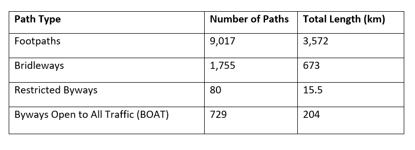
Cornwall’s Public Rights of Way network includes four legally defined types of paths:
- Footpaths – for walking, mobility scooters, and powered wheelchairs
- Bridleways – for walking, horse riding, cycling, mobility scooters, and powered wheelchairs
- Restricted Byways – for walking, horse riding, cycling, mobility scooters, powered wheelchairs, and horse-drawn carriages
- Byways Open to All Traffic (BOATs) – for all of the above, including motor vehicles
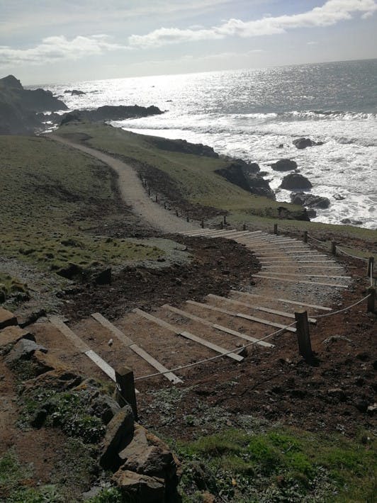
In total, Cornwall has 11,581 paths, including the longest section of the South West Coast Path National Trail:
Countryside Access
Cornwall also has a number of other forms of countryside access which are integral to the way in which people use and interact with Public Rights of Way, including:
Multi-use trails, such as the Camel Trail, Coast to Coast, Mineral Tramways, Clay Trails, and Saints Trail
Over 100 countryside and heritage sites managed by Cornwall Council, including four Country Parks:
- Tehidy Woods
- Seaton Valley
- Kit Hill
- Mount Edgcumbe Estate
Other access sites are managed by partners such as the National Trust, Cornwall Heritage Trust, and private landowners.
Why Now?
Since the last Countryside Access Strategy (2007), Cornwall has seen significant changes:
- A growing, and ageing, population (The Cornwall We Know insight report)
- Increased public interest in outdoor recreation, especially post-Covid (Cornwall and IoS joint Health and Well-being Strategy)
- Pressures from climate change (Cornwall Climate Change Risk Assessment)
- Targets for carbon neutrality (Carbon Neutral Action Plan) and nature recovery (Local Nature Recovery Strategy)
- Encouraging active travel and outdoor access (Cornwall Active Travel Plans)
- Formation of the unitary authority, Cornwall Council.
The refreshed RoWIP will reflect long-term ambitions for Cornwall outlined in our Environment Growth Strategy, the Local Transport Plan, and the Cornwall Local Plan, as well as deliver on the Defra Guidance for preparing and publishing Rights of Way Improvement Plans.
For more information about our Public Rights of Way, please see the 'Important links' section on this page.
The public survey is now closed.
Results are being analysed and will be published here in due course.
Completed consultation events:
Youth focus consultation session on 11th October at Tehidy Country Park for ages 11 to 18 years old: Please use the booking form below to let us know you wish to attend.
Town and Parish Council focus consultation session on 27th October at 5pm: Please email rowip@cornwall.gov.uk if you are a member of a town and parish council and wish to attend.
A formal consultation on the draft RoWIP will be published here in due course, as will dates of any future consultation events.
-
Young People to have their say on Rights of Way in Cornwall
Share Young People to have their say on Rights of Way in Cornwall on Facebook Share Young People to have their say on Rights of Way in Cornwall on X (formerly Twitter) Share Young People to have their say on Rights of Way in Cornwall on Linkedin Email Young People to have their say on Rights of Way in Cornwall link
Young people from across Cornwall are being invited to a free event to have their say on priorities for Public Rights of Way as Cornwall Council revises its Rights of Way Improvement Plan.
The vent will take place on Saturday 11th October at Tehidy Country Park and is open to young people between the ages of 11 and 18.
It is an initiative of the Cornwall Youth Council, who are working with Cornwall Council's Environment Service to embed outcomes towards their goals for young people in the new strategic plan for footpaths, bridleways and byways.
"Public Rights of Way include paths for walking, riding, and driving and we want to hear your ideas on how to make them better."
The event runs from 11am to 3pm and will include a gentle walk.
To register please use the form at: Youth Consultation Event Booking Form | Let's Talk Cornwall
Or for any questions please contact charlotte.evans@cornwall.gov.uk

-
Have Your Say on Cornwall’s Public Rights of Way
Share Have Your Say on Cornwall’s Public Rights of Way on Facebook Share Have Your Say on Cornwall’s Public Rights of Way on X (formerly Twitter) Share Have Your Say on Cornwall’s Public Rights of Way on Linkedin Email Have Your Say on Cornwall’s Public Rights of Way link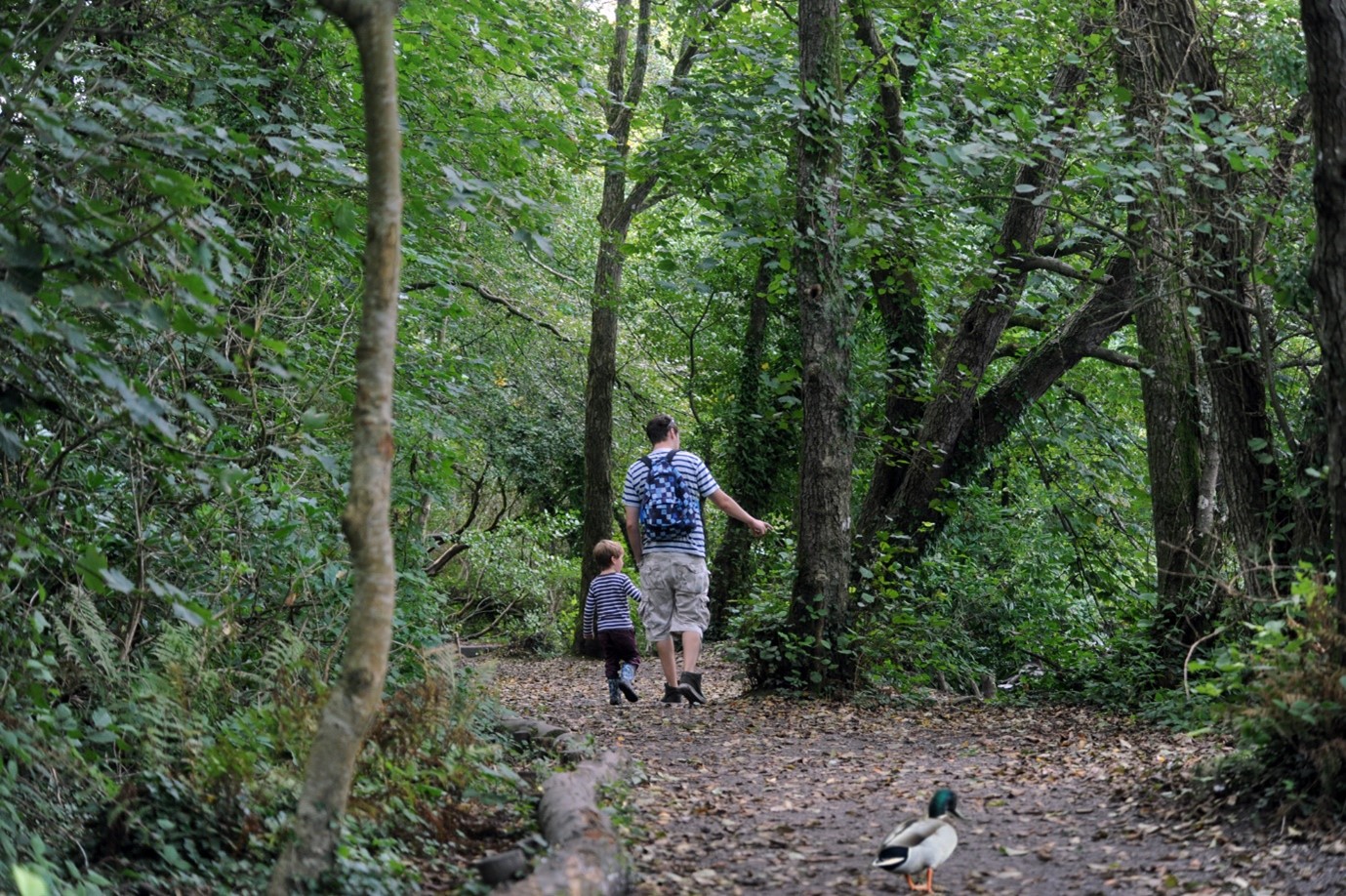
Cornwall Council is inviting everyone to take part in a baseline survey to understand how people use Public Rights of Way (such as footpaths and bridleways) and what they mean to residents, businesses and visitors across Cornwall.
This information will help update the Cornwall Rights of Way Improvement Plan, which will set priorities for managing the network over the next ten years.
What the Survey Covers
We want to hear from you about:
• Why you use Public Rights of Way and what they mean to you
• How you use them – the types of journeys you make andContinue reading

Public Rights of Way in Cornwall

Who's Listening
-

Phone 07749712452 Email charlotte.evans@cornwall.gov.uk -
Email rowip@cornwall.gov.uk