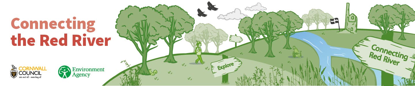
Connecting the Red River
Connecting the Red River is an ambitious project seeking to understand long-term environmental change in the Red River Valley in order to design enhancements and inform management that will deliver:
- Water Environment Benefits and Nature Recovery
- Improved Accessibility and Connectivity with a Nature-rich Landscape for People
The Red River is steeped in history and character, from its source near Bolenowe, through the mining heartlands of Brea and Tuckingmill right through to the coast at Godrevy's iconic dune-flanked sandy beach. It pours through a landscape that has been modified by human activity over centuries of mining industry that has resulted in the river being predominantly contained in a constructed channel, disconnected with the natural floodplain.
 Helping to re-naturalise the river's environment could bring greater diversity of rare wetland habitats, and the wildlife these support. Additionally, the Red River Valley has long been a place for people, historically a place of work as well as leisure, and a natural corridor between the urban area and the stunning coastline.
The project brings together Cornwall Council and the Environment Agency in a new collaborative approach which, if successful, will identify landscape opportunities for multi-functional benefits, addressing the priorities of each organisation.
The project, which will run from April 2022 to August 2022, will result in the production of a Vision Plan for the Red River from Tuckingmill to Godrevy, the development of which will include direct consultation with the community, landowners and other stakeholders.
Community workshops will be held as part of the development phase and we encourage you to check here for details of these, plus information on other ways to feed into the initiative.
Cornwall Council would like to thank the Environment Agency for making this project possible.

Who's Listening
-
Phone 07749712452 Email charlotte.evans@cornwall.gov.uk

What are they doing to the bridleway between Menadarva and Coombe. I've waked and cycled this route for donkey's years and enjoyed the tranquility, countryside feeling and nature for the whole 1.6 km (I miles). It is a wet valley with the river running close to the path but that is what defines its character, a challenging winter walk and delightful in summer.
On riding along it yesterday I see that, along with a number of other originally country walks in the area, the character is about to be destroyed and replaced with some sort of road costing hundreds of thousands of pound and for what purpose.
I realise that the funding for these schemes comes from different pots but if this is a priority job for this pot then the pot has too much money.
What a waste !
Can we open up the menadarva path to godrevy and reinstate the nancemellin path which is overgrown and barred off probably illegally …
This comment is made by the site administrator in response to comments here about the deterioration of boardwalk and bridges in the Red River Local Nature Reserve:
Cornwall Council are aware of the deterioration of the boardwalks and bridges in the Red River Local Nature Reserve, however they are on non-statutory paths in a time when our budgets are not keeping pace with maintenance needs on statutory rights of way and sites, hence have not yet been prioritised for repair. The stretch of boardwalk that is currently closed between Roscroggan and Reskadinnick has a cost estimate of over £60,000.00 to reinstate, which is a considerable amount to find from highly pressurised budgets that are prioritised towards statutory duties and the highest health and safety needs across the Environment Estate. This regrettable situation does not, however, deny the significance of accessing these sites for the community, and Cornwall Council are constantly seeking opportunities to apply for external funding to support provision of access in the Red River and will continue to do so.
Paths are cleared of vegetation on an annual basis, and overgrowth along the Mennadarva stretch of the route was cleared in March 2024. If other stretches have become overgrown, please do contact environment@cormacltd.co.uk with a location and it will be looked into.
The bridges are now in a state of disrepair and the paths are very overgrown. It is still a beautiful walk. Pity 2 years on and nothing seems to be happening!
Its a lovely peaceful walk, ruined totally by not continuing through the last 1 mile or less to Gwithian. A pedestrian gate that looks like a footpaths agency construction is at the end of the path opening up into overgrown boggy farmland. There is a sign stating no further public access. At the Godrevy end next to the bridge there are two footpath posts with a plaque attached which is no longer readable. I believe it may have been a notification that the footpath had been closed. Behind it is clearly an overgrown path heading through gorse bushes in the direction of the gate mentioned a mile away. From high ground a distance away it looks as if a long stretch of straight path? or just the line of the riverbank, runs between the two points. There is also a bramble clogged wooden bridge across the Red river midway ,that looks like it was built by a footpaths agency?
Another series of stiles crosses fields from green lane towards the location of that bridge but peters out short.
I would love to know if a route now closed had existed. It would be great to get landowners to allow all these connections,as at the moment the area has a lot of disjointed paths that can only be backtracked.
Treswithian circular pathways walk of the Red River.
This year's August longer group walk started at the Trevithick Inn, Camborne. First we had coffee and poured over maps and books on the history of the Red River from Frank Turks articles in the 1970s to the Camborne Town Council booklet walk, a route that was similar to ours.
Part of our discussions is to link up pathways and Saints Ways from Troon and Treslothan to Gwithian. Something that David Oates and myself discussed many years ago.
After a historical talk on Treswithian and the Glebe lands of Crane Manor we followed the main road to Weeth Road. We then turned left down Marriot's Road through new housing that leads to a footpath beside the A30 embankment to Willow Drive.
We discussed the impact of noise pollution on homes, here very severe as the land forms a hollow that echos the noise off the motorway. We looked at the motorway drainage leats and the local watercourse underpass now within quite a dense corridor of trees on the embankments. This supports a surprising amount of wildlife. This can be good or bad as road kill and isolated areas of natural verge growth can encourage biodiversity but also subject species to severe pollution.
There was a lot of rubbish around the leats and drainage courses and they did not look very attractive and a further source of pollution into the Tributaries of the Red River.
We explored the popularity and folklore of Kissing gates at the park at the bottom, an attractive area beside the trees except for the motorway noise.
Here we joined Reskedinnick Lane noting how the A30 divided up the old Government Horticultural Experiment Station, here they tested flowers and vegetables under Cornish weather systems. On the southern side of the A30 are isolated fields that are now to be built on with housing causing severe impacts on the local infrastructure and the Red River Tributaries.
We continued under the bypass and considered the graffiti, whether it would be possible to have workshops with young talented graffiti artists to help make such places feel more safe and attractive. Perhaps reflecting the local environment and culture of the area.
Down the pathway of Reskedinnick Drive we noticed the beautiful gnarled oaks along the stream to the left and the boggy land that increases as we approach Reskedinnick House Grounds. The stream used to be accessed up through some fascinating enclosures up to the water underpass under the A30 on the north side but this has now been gated.
On the right of the path are some wetland areas and many plants from the old Horticultural Experiment Station, now Duchy College. This now all looks neglected and we felt that as this is an important area of valley wetlands on the Red River Tributaries the area should should be upgraded in conservation status.
We noted the history Of Reskedinnick House, the former 19th home and woodland estates of Captain Vivian of Dolcoath Mines. The author Ann Hugh's wrote lovingly of the way of life here and the many friend's they had. Several writers, scientist's and artists have lived in Reskedinnick and felt drawn to the still rural feeling of Puggis Hill lane. Many of our group were intrigued by this name.
Where the footpath joins Puggis Hill lane we continued straight on towards the Red River and Roscroggan, on a corner over a gate we admired the view over the marshlands of the River towards Coombe.
We continued along the lane passing the cottage Shangri-la and paid homage to the memory of Frank and Stella Turk, in many ways the inspiration and backbone to the conservation of this area. At the end of the row of cottages was a watermill and here we turned left down a track to a wooden bridge over the Red River itself.
We noted how greenish yellow and pink the water was looking and the accumulation of sediments on the rocks. We also looked at old photographs of the extensive Tin Stream Works here and contrasted it with much recent regrowth of Willow and Alder now forming a rich and often flooded habitat of biodiversity. Even I remember the old red slime clay banks that we used to walk over now completely covered in overgrowth, a brilliant sight.
We continued along the Red River towards Coombe on old minings paths of clay still filled with gorse, heather and broom. We then approached a timber boardwalk over a much more natural wetland area that still gets boggy in winter, the boardwalk was built by a team led by Phil Harris many years ago. But the boardwalk is now starting to fail in places.
The Red River Path continues towards Keive Mill passing an outlet into the Red River from the Sewage Works on the hill opposite. This was looking pretty unattractive and smelly with evidence of mining mineral accumulation mixed with pipe outfall evening turning the moss bright orange!
Some of the valley here still has extensive areas of compacted mineral clay areas where only gorse, heather's and broom thrive but contrasts with damper areas where there is an impressive amount of regeneration, natural and planted, that helps to form a rich biodiverse area.
Coming out onto the lane by Cuttings Hill we turned left again down the green lane, over bridges of the Red River and Tehidy stream where they join. We continued down about a mile to the footpath opening to beautiful Bella Lake noting some red fungi!
The boardwalk to the side of Bella Lake is now mostly rotted away and dangerous as near to the edge of slippery banks. This is a superb area for dragonflies and otters have been seen recently (Phil Harris). The mill lake used to be a lot bigger and this can be studied on maps. We continued up the hill towards Grass Valley and stopped for the superb view of the Red River Valley woodlands towards Menadarva and Gwithian to the West and towards Tehidy Woods to the East. Here in an area where the farmer has left an area to grow more naturally we had a picnic. On leaving we discovered a toad had joined us!
Coming back by Grass Valley we noted the sites of ancient wells or springs. Here, new ponds or lakes have been created down to marshes by the Red River (a footpath stile is blocked here), large gardens with apple trees and orchards indicative of long term land usage (unfortunately a large area of orchards has now been cut back). There is a large site of previous market gardening now grown wild with a large number of car wrecks including a fascinating modern memorial by the footpath wall. In the wooded area long narrow fields are indicated by air photographs making this a fascinating area of local community land usage. A good area of study for regenerating community integration of wilderness habitat areas and natural land usage of local resources, such as coppicing, orchards, wetlands and access.
We completed our walk by field footpaths and green lanes to the Treswithian Motorway intersection where we started at Trevithick Inn.
Our next walk in this area from Trevithick Inn will be to Menadarva to explore routes towards Gwithian hopefully this autumn. Philip.
I have been walking the Red River Tributaries area since 1968. Nature Recovery since then led by Naturalists such as Stella Turk and Colin French and the end of mining has been heartening. Now mining is back again with new technologies. There needs to be more joined up thinking between all of the tributaries, regard for historical process and the terrible enclosures and land improvements of the 19th century that led to a lack of access. Local land gardening in line with organic soil improvements, tree cover and protection of Commonlands. The semidune systems east of Gwithian are under threat of large scale cattle tramping, the footpath through the fields to the former gamekeepers bridge is dangerous to walk on. We were chased all the way last year. Saw otters by the bridge. The green lane from Nancemellin to Nanterrow Farm has been blocked and some of the hedges taken down. This Green Lane has lovely views over the Red River Valley and many people used to walk this way from Camborne. Few of the green lanes north of Roseworthy, which is a dangerous main road start to a footpath, have been regd as bridle ways as compared to the south of Roseworthy. This is neglect by the Council. A superb walking route could be created from Boswyn by Copper Hill to Gwithian exploring the many important archaeological sites including St. Ia Chapel, Carwynnen Quoit, The Hood Round and Crane Manor, Godrevy Sand dunes. All of these could link up with King Edward Mine at Troon, Duchy College wetland down Reskedinnick Valley, my own proposals with Treslothan Parish and Church as a walking Centre. Several footpaths are blocked at Carwynnen. Car racing are ruining the woods at Nancemellin where old maps show a footpath along the river. Serious discussion needs to take place between landowners and the Council, the benefits to community including health, nature recovery and improvement for quality goods. Wetland improvements are essential.
I have yet to explore the Red River valley. However, I regularly go surfing and Godrevy and have a particular concern about pollution coming from the Red River. I have also spoken with the RNLI lifeguards about sewage pollution and they have told me that at times it is noticeable by smell and well as discolouring discharge at the mouth of the River. They also said that they do not get reliable warnings about pollution. It seems to me that a reliable and timely warning system would also be of use for those exploring the river.
My husband and I visited the Red River nature reserve on 19 May and were dismayed to find woeful neglect of the pathway through. We were scratched and whipped by gorse. A most unpleasant experience. We never saw a single bird or butterfly.
Seen both at Tuckingmill and Godrevy end - would love to attend Workshops, please.
Hi - I am a regular walker and user of the Red River Valley / Kommhelik and would like to be involved. I am also a Cornish speaker and forager.
Oll an gwella
Matthi