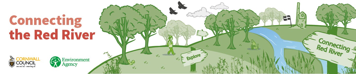
Connecting the Red River
Connecting the Red River is an ambitious project seeking to understand long-term environmental change in the Red River Valley in order to design enhancements and inform management that will deliver:
- Water Environment Benefits and Nature Recovery
- Improved Accessibility and Connectivity with a Nature-rich Landscape for People
The Red River is steeped in history and character, from its source near Bolenowe, through the mining heartlands of Brea and Tuckingmill right through to the coast at Godrevy's iconic dune-flanked sandy beach. It pours through a landscape that has been modified by human activity over centuries of mining industry that has resulted in the river being predominantly contained in a constructed channel, disconnected with the natural floodplain.
 Helping to re-naturalise the river's environment could bring greater diversity of rare wetland habitats, and the wildlife these support. Additionally, the Red River Valley has long been a place for people, historically a place of work as well as leisure, and a natural corridor between the urban area and the stunning coastline.
The project brings together Cornwall Council and the Environment Agency in a new collaborative approach which, if successful, will identify landscape opportunities for multi-functional benefits, addressing the priorities of each organisation.
The project, which will run from April 2022 to August 2022, will result in the production of a Vision Plan for the Red River from Tuckingmill to Godrevy, the development of which will include direct consultation with the community, landowners and other stakeholders.
Community workshops will be held as part of the development phase and we encourage you to check here for details of these, plus information on other ways to feed into the initiative.
Cornwall Council would like to thank the Environment Agency for making this project possible.

-
Consultation on Camborne Life Cycle (Roskear Route)
Share Consultation on Camborne Life Cycle (Roskear Route) on Facebook Share Consultation on Camborne Life Cycle (Roskear Route) on X (formerly Twitter) Share Consultation on Camborne Life Cycle (Roskear Route) on Linkedin Email Consultation on Camborne Life Cycle (Roskear Route) link
As part of the Camborne Town Deal, the Roskear Route will provide 3.7km of enhanced walking and cycling route, connecting the town centre with the surrounding green space.
The scheme will secure long-term access from Camborne town centre and key residential areas to the surrounding green spaces including the Red River Trail, Tehidy Woods, North Cliffs and Godrevy, the Great Flat Lode Mineral Tramways (with onward connections to the Devoran to Portreath trail) and Tuckingmill Valley Park.
The proposals are comprised of 8 separate locations with a variety of measures to enhance walking and cycling provision across the town. ProposalsContinue reading
-
Red River Vision Plan released
Share Red River Vision Plan released on Facebook Share Red River Vision Plan released on X (formerly Twitter) Share Red River Vision Plan released on Linkedin Email Red River Vision Plan released link
Over the past six months the Environment Agency and Cornwall Council have been working in partnership to develop holistic vision plan for the Red River corridor from Tuckingmill to Godrevy.
One result of this collaboration is a Vision Plan document outlining key trends and opportunities for the corridor over the short, medium and long term.
Additionally, the partners, along with other key stakeholders will be continuing to work together through a steering group format to keep a holistic focus on the Red River, prioritising and, where possible, progressing towards opportunities identified in the vision plan.
If you are interested inContinue reading
-
Notice of Public Consultation Event
Share Notice of Public Consultation Event on Facebook Share Notice of Public Consultation Event on X (formerly Twitter) Share Notice of Public Consultation Event on Linkedin Email Notice of Public Consultation Event link
The Red River runs from Bolenowe through the industrial heartland of Pool and Brea Village, under the A30 at Tuckingmill and out to meet the sea at Godrevy. Cornwall Council and the Environment Agency are jointly running Connecting the River to explore how the river is changing and consider enhancements for people and nature recovery. The focus area is the main river north of the A30, from Tuckingmill to Godrevy.
Come and have your say on the opportunities we are exploring through the vision plan project.
Event information
Thursday29th September
Drop in: 2pm – 7pm | Presentations: 2.30 and 6pm (replicated)
At The Red River Conservatory, Heartlands, Pool, TR15 3QY | www.heartlandscornwall.com
If you can't attend but would like to give share your ideas and feedback with the project, please complete our survey on this website: Connecting the Red River | Let's Talk Cornwall
Or contact us via the contact information below:
-
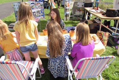
Community Walk to "Camborne's Shangri-la"
Share Community Walk to "Camborne's Shangri-la" on Facebook Share Community Walk to "Camborne's Shangri-la" on X (formerly Twitter) Share Community Walk to "Camborne's Shangri-la" on Linkedin Email Community Walk to "Camborne's Shangri-la" link
On Sunday 28th August members of the Treswithian Circular Pathways Community Group headed away from the town, down into the Red River Valley over a route that demonstrates both how easily connections between the town and the Red River could be improved today, as well as the rich cultural and historical connections that underpin why the valley has been called "Camborne's Shangri-la".
The following text summarises a report submitted by the group as part of Connecting the Red River's community consultation process - If you want to submit your stories of the Red River to also inform our project, pleaseContinue reading
-
Red River Rescuers celebrate 10 years of conservation in the Red River Local Nature Reserve
Share Red River Rescuers celebrate 10 years of conservation in the Red River Local Nature Reserve on Facebook Share Red River Rescuers celebrate 10 years of conservation in the Red River Local Nature Reserve on X (formerly Twitter) Share Red River Rescuers celebrate 10 years of conservation in the Red River Local Nature Reserve on Linkedin Email Red River Rescuers celebrate 10 years of conservation in the Red River Local Nature Reserve link
On Sunday 10th July ecologists and interested individuals joined the Red River Rescuers to celebrate their 10th anniversary on a special Dragonfly Day, in which members of the conservation group were able to see the fruits of their labour – various species of dragonfly and other wetland wildlife conserved in the Red River Local Nature Reserve as a result of the habitat management carried out over winter months.
The day started at Great Wheal Seton, a former tin streaming works of the c.1870s which is now home to number of scarce and rare species of insects reliant onContinue reading


Who's Listening
-
Phone 07749712452 Email charlotte.evans@cornwall.gov.uk
